I haven't done a single bit of distance walking since coming back from Andong. I'll start again next week with 9K walks out to the Han River and back, and with longer walks on the weekend. During the winter—if I have the willpower—I'll try to do all of these walks early in the morning, but I make no promises. While it's easy for me to get up at 4 a.m. when I'm on a long walk, once I'm back to my "urban slob" self, I normally revert to sleeping late and waking up late. Changing that schedule may be asking too much. We'll see. Meanwhile, work has been quiet, but getting back into that routine has proved easy. The heel of my right palm seems to be mending even if it still looks bad, but by the one-week mark (this coming Tuesday), I expect not to be wearing a bandage anymore: the damage to my hand isn't nearly as bad as the damage to my foot was. I'm still trying to get back into my pre-walk dietary rhythm; that's proving more difficult than one would think. I have, however, accomplished a few major things on my post-walk to-do list, which is why I now have time to work on this postmortem.
Introductory Remarks
The initial motivation for doing this walk was to silence those easily bored coworkers (they have, by now, almost all left the company) who kept yammering about how I needed to do the Four Rivers trail backwards for a change of pace. I knew that ending at Incheon would be anticlimactic, and considering all the medical shit I'd gone through this year, I also knew it was probably not a good idea to do a full-length, over-600K trail. So I settled for doing just the Nakdong River jongju, which goes from Busan to Sangju, just like the Four Rivers, before turning east at Sangju and going roughly due east to Andong, following the Nakdong River for most of the way, with only occasional divergences whenever the path swung temporarily inland (385K). So up to Sangju, I was doing the trail backward; from Sangju to Andong, I was doing the trail forward, as I had done two years earlier (Jeju Olle + Nakdong trail).
What made things different, this time, was the foot injury: I developed the biggest foot blister I've ever had, and that's how I discovered that some blisters can't simply be taped over and walked on. Rain along the way, during the first eight days of a twenty-day calendar, didn't help matters, and I probably could have taken care of my feet better instead of relying on bravado. It's also possible that my hospital stay in August didn't do me any favors in terms of hardening my feet for a long walk; part of me is convinced that that experience tenderized my soles a bit, making them ready for blistering when the rains hit. So I may have to revise my walk-through-it rule about blisters, knowing what I now know. I don't want this same thing happening two years from now, when I distance walk again (remember: next year, I'm hitting the States to visit friends and relatives, so any distance walking will be incidental).
As a result of the above factors, I had an injured foot by Day 8, upon which I couldn't walk. Day 9 of the walk was a rest day, anyway; I rested in Hyeonpoong at the Hong C Motel for a day before going back to Seoul on what would've been Day 10, but I didn't count it as such. I spent a month convalescing at my place in Seoul, then restarted the walk for the final eleven days (Day 10 to Day 20) on November 30. I pre-taped the shit out of both of my feet, fanatically anticipating all hot spots. I had several types of tape to help out with this; that variety proved surprisingly useful for different body parts and different angles.
And the strategy worked. My feet, when I restarted the walk, were perfectly fine. It helped that we had moved beyond the rainy season to just pure coldness. That in itself was a problem, though, which I'll talk about in a bit, but I felt fortunate not to have to deal with wet feet and wet footwear for miles and miles. Also: the cold meant my feet didn't get all that sweaty, and neither did the rest of me, which allowed me to keep my tape and bandages on for longer, taking them off only when I would infrequently shower. The cold weather required me to bundle up pretty much the same way every single day, with the early-morning chill starting off as simply cold before turning into subfreezing temperatures.
One logistical problem resulted in, once again, the loss of a new pair of gloves ("new" = from a couple years ago). I was able to walk with my old pair of gloves, which are textured just like Darth Vader's. The only difference is that mine have these goofy white stripes running across their backs, which makes them look less menacing. The logistical problem was that it was more comfortable for me to remove one glove totally in order to use my phone's camera. This constant remove-put on-remove-put on alternation led to my right glove's finally jumping ship with a quiet I'm outta here, and with the right glove gone, there seemed little point in keeping the left glove. Now, whether I was wearing one pair of gloves or two pair on my hands, my fingertips would always end up frozen. After I lost/got rid of the new pair, I resorted to just jamming my hands (or hand, really) into my pockets (or pocket, really) and balling my hand/s up into a fist to keep it/them warm. The hand holding my trekking pole had to remain exposed to the elements, so it ended up in a pocket only infrequently. I was generally left-handed when using the trekking pole, but I would occasionally alternate. There was even a day where things were so cold that I tucked my trekking pole into the space at the small of my back so I could stuff both of my gloved hands into my jacket pockets to warm them. Anyway, I lost one pair of gloves, and because I was still taking pictures the whole time, my right hand was often exposed to the freezing morning temperatures. The skin of my right hand is currently used and rough-feeling even if it doesn't look all that affected by the trip.
My diet along the way was a combination of local-restaurant food, convenience-store grub (plus snacks), and Survival Tabs. I was supposed to eat the Survival Tabs (which were also fairly carby despite their low calories) on days when I was otherwise fasting, but I ended up eating regular food almost every day except for one or two. I don't think I did my blood sugar any favors, and I doubt I ended up losing much weight. I'll be checking my stats this coming Monday after I've had my weekend fast. We'll see how things are then.
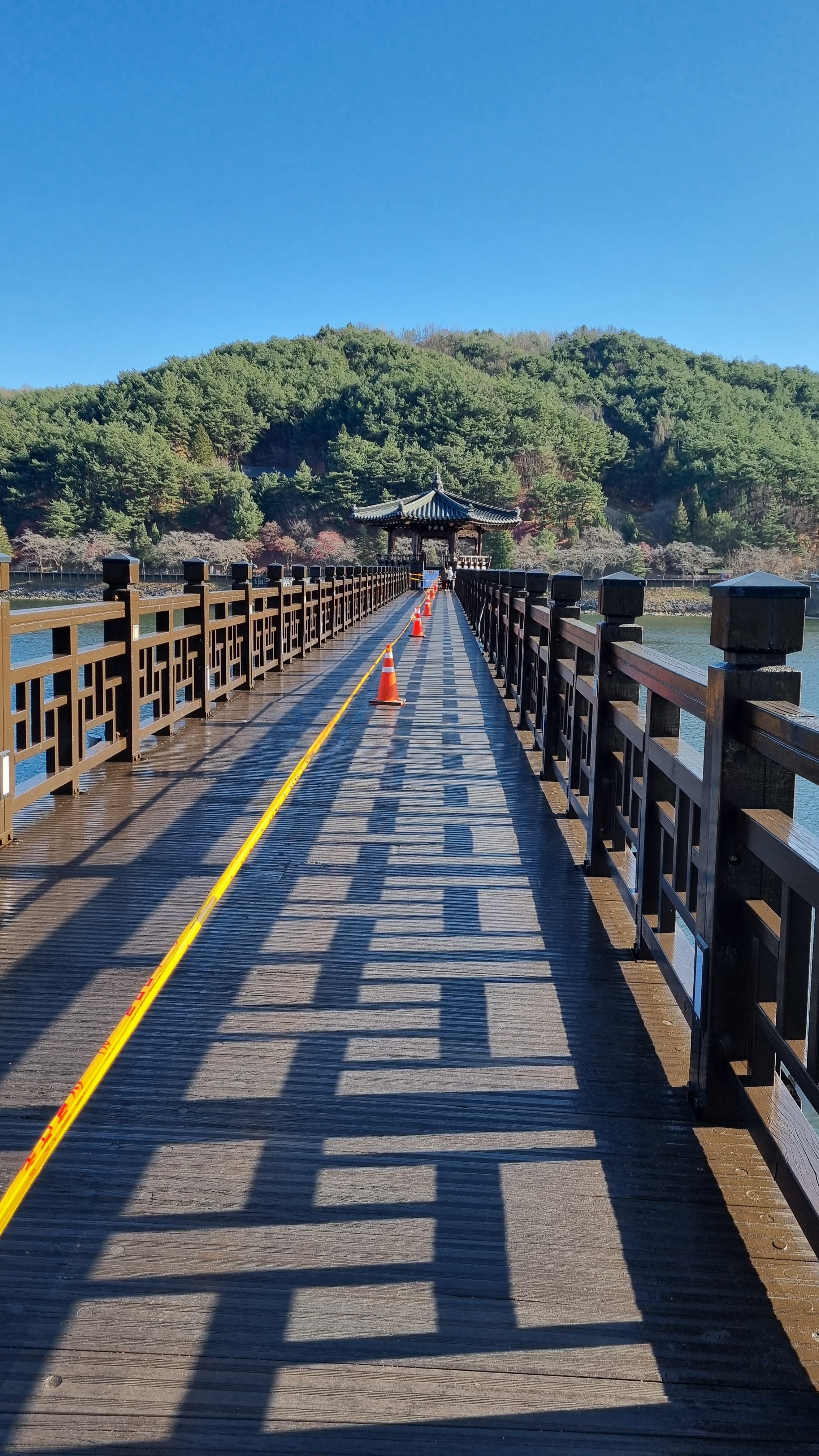
During the first eight days of the walk, I hit one monster hill and avoided two others. During the final eleven days of the walk, a few rises took me by surprise: they'd been descents when I'd travelled south to Busan along them on previous walks, so they'd never registered as hills, per se. The final walking day, this past Tuesday, reminded me that that final segment actually has two significant hills along it, with the second one being much worse than the first one.
Some stats from the walk:
Average daily distance walked (walk days only): 28.8 km
Total steps walked: 689,432
Equipment
Review (skip)Some of my readers say they skip this part of the postmortem; I've helped them along by giving them a skip link (see above) that will take them past this section.
Clothing. Because I was walking so late in the year for the second half of the trek, I took along a lot of extra gear, which all managed to fit into my smaller backpack when I took the clothing off, bit by bit, during the day. In October, I had days where I would start off wearing a coat and then would be down to a tee shirt (with my recently purchased UnderArmour long-sleeve shirt underneath, acting as toshi/manchettes and armpit-friction protector). I also brought along a heavy-knitted winter vest that bulked out my rain jacket and essentially turned it into a coat, except for the sleeves, but that proved not to be a problem even as the weather got colder. My arms only ever got slightly cold. The jacket and vest kept me snug and warm, but the jacket's zipper is done Korean-style (= US women's-style clothing), i.e., with the zipper pull located on the left side. That, plus the stiffness of the jacket's fabric, made putting the jacket on a bit of a chore every morning. (Aside: my down winter coat has an even worse zipper problem.) My pants held up fine, despite my fall; I didn't tear any holes into the fabric this time around, thank Cthulhu. My tee shirt, the 2023 walk shirt with only a front image to prevent the backpack from rubbing out the back image, was pretty much an irrelevancy since it was mostly hidden behind the jacket and vest. But it was an extra layer. My UnderArmour shirt did a great job of keeping my armpit skin, bulked out by fat, from rubbing against itself and causing irritations. My expensive Sheath underwear again proved its mettle; it's a bit of a boxer-brief combination that looks—on me, anyway—a bit like black shorts. Its claim to fame is the little interior pouch for the ball sack and the tasteful mouse-hole for your serpent to poke out of. When you have to piss while on the trail, though, the folds of cloth can be a maze for your cold-numbed fingers to get through, especially when you're wearing a thick jacket and vest. Overall, a thumbs-up for Sheath because it's comfortable, but I don't think I need all of that overcomplicated cloth between me and the open air when it's time to drain the dragon.
Headgear. I had two winter hats. The "inner" hat was a mere over-the-skull cap that a coworker of mine used to call a "beanie." On top of that, in the early mornings, I would also wear a second, balaclava-like hat that was essentially a ski mask, leaving only my eyes exposed and going down to my neck. These two layers proved perfect for my walking conditions. Alas, because of my constantly running nose while on the trail, the ski mask probably ended up taking on a combination of condensation from my breath and snot from my nose. I gave the poor thing a thorough wash when I got back to Seoul.
Neckwear. I had a scarf on me at all times; my ski mask also protected my neck somewhat, and my winter vest had a high collar that stood tall if you zipped the vest up fully. With three layers of protection, my neck was in no danger of getting cold.
Footwear. I wore a thick pair of wool walking socks, and since I washed them not at all, there was never a drying problem. I was sure to wash my feet, though, whether showering or not. My new shoes, bought for the second half of the walk, were great thanks to their wide toe box. My toes did indeed feel comfortable, and partly thanks to the better weather (almost always sunny, and no precipitation), I developed no blisters at all. Nothing beats having dry feet.
Trekking pole. Well, I didn't lose it this time. Alas, I'm down to my last rubber goat's foot; the bag of rubber feet that I'd ordered came with only a few goat's feet and lot of stubby rubber ends. I guess I'll be using those from now own, but I admit I'm tempted to see whether it's possible to order only the goat's feet.
Phone, charger, portable WiFi, etc. The stuff in my "tech bag" saw a bit of use, but I don't think a single motel or pension lacked WiFi this time around. My poor phone was exposed quite often to the cold, but the tougher battery (tougher than that of the Samsung Galaxy I'd purchased in 2014) endured the low temperatures just fine. My charger cords were also satisfactory this time; there may have been only one or two instances of the "slow charging" warning appearing on my phone—probably because of the power output at the places where I slept and not because the cord was bad. The weak link in the chain, this time, was my portable power pack; either it's old, or the cold killed it this time around. I could get a few hours' charge out of it, but it would run out of juice before a given walk was halfway through. No matter; the thing got me through some low-charge moments, and I normally buy new power packs once every couple of years, anyway. They don't seem to have changed much over the last decade.
First-aid kit, meds, and other pills. I used up all of my vitamin pills and other supplements (magnesium, curcumin, Omega-3, potassium, Vitamin D), as well as all of my BP and blood-sugar meds (the old-man pills), not to mention the anti-stroke meds. I brought along my insulin pen and its accessories for the second half of the walk, but two days before the end, I had a senior moment and left two insulin pens in the motel fridge. No stress. I texted the motel manager to just throw the pens away; I wouldn't be coming back for them. I relied almost daily on my first-aid kit, which included rolls of strapping tape, to re-tape my soles when needed, and I used plenty of bandages as part of the pre-taping: their gauze pads undoubtedly helped to keep my soles' skin from becoming irritated, and every time I felt another hot spot on my foot, I would bandage it up that very evening to be able to make it through the next day. But the dryness of the December weather definitely helped with all of that: had it rained, I might've found myself right back where I'd been in October.
Survival Tabs. Survival Tabs were light and easy enough to carry. I used them on days when I thought I might otherwise be fasting, but my hunger would eventually persuade me to buy food at a restaurant or convenience store, so the Tabs often acted as snacks to stave off hunger for a few hours. They're chalky and powdery, and they taste a lot like powdered milk despite their supposedly different flavors: I had chocolate, butterscotch, vanilla, and strawberry, and the difference between these flavors was minimal at best. Would I use Survival Tabs again? I don't know. They're meant as last-ditch nutrition in emergency situations: imagine a father of a family of five in the recent flooding in the States doling these tablets out to his wife and kids. They're packed with basic nutrients and are meant as a stopgap, a sort of culinary first aid to get one stabilized until one is in a place to get a real meal. They're not meant as a true meal replacement, especially given their low caloric value: a single serving for an adult, about 12 tablets, is 240 calories. I would eat an entire pack of 24 tablets (480 calories) in a single sitting. Seeing as I was burning thousands of calories per day, though, I don't think the Tabs contributed to any weight gain.
What Was It Like Walking the Trail Backward?
Walking the trail backward from Busan to Sangju was strange. As I approached certain areas, this would trigger memories of what was just around the corner or over the hill, but there were also plenty of times when the mere fact of the reverse order of travel meant that I had no idea what was coming. If I did the trail backwards several times, I imagine I'd get used to it, but these days, with my old brain less and less able to retain information, I doubt that such repetition would help much. Occasionally, though, not knowing what was next would lead to some pleasant surprises, and knowing what was next would lead to a little glow of anticipation. The first day, however, felt especially weird as I walked out of Busan to the nearby city of Yangsan. It felt even weirder to stay only one night in Yangsan—a city I normally spend two nights in. But as with everything else in life, a person gets used to the parade of strangeness. That said, it was still a relief to hit Sangju and to go "forward" again to Andong.
Nature
When I was walking the trail in October, the usual wildlife was out and about, but when I convalesced during November and didn't restart until November 30, most of the wildlife had retreated as the cold descended. No more Joro spiders, no snakes or earthworms, and only a few cold-addled grasshoppers would show up in the afternoon, when temps were high enough for them to move at all. Meanwhile, the fields were mostly brown, but there were still more than a few growing garlic and other crops. The persimmon trees were the bizarrest sight, I guess: while the persimmons had fallen from most trees, there was one town where the persimmons had remained on the branches, but as I got closer to those trees, I realized that the fruits had a saggy, limp look about them. Were these the fruits being saved to make got-gam, i.e., dried persimmons? I'll have to ask someone about the got-gam-making process. Otherwise, nature was settling in for winter, quiescent and bare. It was a quiet walk in all, with relatively few bikers, especially in December. An introvert's paradise.
Final Thoughts
In the comments to my posts, I got pushback from friends about my judgment that this walk had been a failure. As I wrote in my book, though, you judge based on performance, not effort, since you can't be a mind reader. And while I can understand the impulse to evaluate someone's deeds according to that someone's earnestness, I see things differently. A series of misfortunes and mistakes led to my foot injury; I could have been better prepared and less filled with bravado. I should have acted sooner the moment my feet began to display problems, and one lesson I've learned is the need to bring along dry socks and footwear. It might also be wiser not to walk in heavy rain. Then again, I think the rain was only an exacerbating factor, not the fundamental cause of my injury, which had begun to form before that particular rain. Finally, despite my weight loss up to now, it'll be necessary to lose a hell of a lot more weight as a way to keep pressure off my feet. Pressure, friction, and moisture: the three most important, and interrelated, causes of blisters. If nothing else, I'll be more mindful in the future.
Did I like hiking in December? Yes and no. I can't help thinking I got lucky in having such bright, sunny weather for the latter half of the walk, but the trade-off was the cold: my exposed hands suffered a great deal from the cold. I'll have to read up on how others who walk and travel-blog deal with these sorts of conditions. Otherwise, its probably better to continue walking during the fall. At least that way, I won't need winter gear.
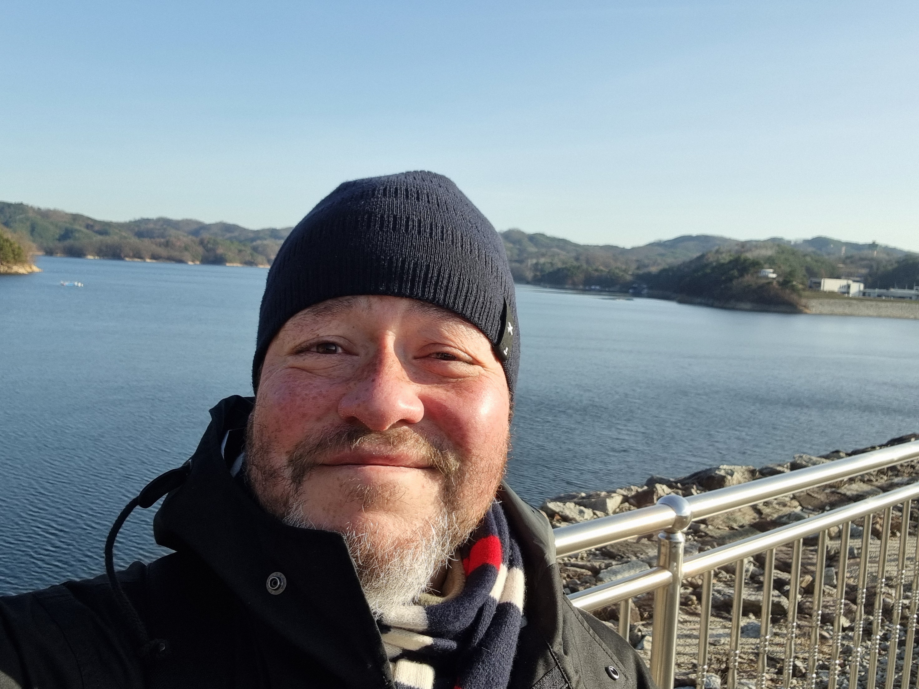
Still and all, I'm glad I went back to finish the walk. Giving up in medias res would have nagged at me; it would have been hard to live with myself had I not done the final eleven days of my itinerary. In the end, despite the sense of failure, it was an overall happy experience; the Nakdong is a beautiful river, full of its own quiet dignity, and just as I'd imagined it would be, the final day's walk to the dam was fulfilling—a worthy and proper capstone to a long trek. The view from the dam's top is truly magnificent. Just don't ever eat at Goshen Pizzeria.
Righto—my next walk will be in two years, either a landlubber's path across the peninsula, east to west, per a suggestion from Paul Carver, or a possible walk down the west coast (which I need to reconnoiter). Have a good rest-of-December. Stay warm.