Tuesday, October 15, 2024

Day 0, Leg 0: in Busan, up at 3 a.m.

It was an uncomfortable ride on the SRT down to Busan. I gave up my seat to an older couple about 40 minutes into the trip and rode in between the cars in the "cattle" section with all the overbooked passengers. Long story as to what happened and why. Tonight, I just want to get four hours' sleep so I can walk to the station and cab over to my walk's starting point. First stop: Yangsan. It's a straight shot north, mostly along the river before I need to use my brains to navigate inland toward Mulgeum Station in Yangsan and my usual motel, Bliss. (Is that tacky enough of a name for you?) I think Naver Map had listed the trip as 30K, but I think it's closer to 28 or maybe 29K. So no two-night break going north even though two nights at the Bliss is my usual m.o. when going south

Lots of homeless people setting up camp at Busan Station for the night, and it's definitely hotter here. I look forward to the coming coolness as I lumber north and east. I think 3 a.m. is going to be my new wake-up time this walk, given how slowly I now move. I'll need the extra time to cover the same distances. 

Naver Map went crazy when I tried to find my usual motel, the Gwangjang, which is right by one of the station's exits (#4—remember it's #4!). The dot representing me kept jumping all over the place, and the damn thing was leading me in circles. I ended up walking all over the place. Earlier in the day, my T-Money Go app was also not working. Is there a problem with my phone? If there is, then I'll have to rely on old-school, commonsense navigation, and regular blogging might not be possible. We'll see. 

I was tempted to take pics of the homeless folks, but I didn't want to get yelled at. Because Korea is ethnically less diverse, it's not like Paris where the Gypsies (excuse me—Romani) infest the major train stations with their begging. These people I saw tonight simply planted themselves singly or in groups under the station's projecting edges to protect themselves from the occasional rain. (The ground was wet when I arrived, but there was no precipitation.) There was no begging that I could see. 

At the office, before leaving, I got into a stupid argument with my boss about carrying insulin with me. I don't want it in my pack when there's direct sunlight plus my body heat; my boss quickly did 30 seconds of research and argued, with his newfound expertise, that insulin can be carried for weeks at up to 25°C, and with temps coming down everywhere at this time of year, there was no problem with overheating. He also seemed fixated on the idea that I would die without insulin. I don't know why (ego), but I countered that walking will take the place of insulin in terms of effectively lowering my blood sugar... as long as I really behave myself this time. Plus the rest of my meds, the pills (which I did take along), already do at least 80% of the heavy lifting, medically speaking, and the only reason I'm on meds is that I haven't had the self-discipline to regulate my food consumption up to now. But after a stroke and now a heart attack, I think the time has come to heed the voice of the cosmos, so I'll be doing my best not to go off the chain during this walk. If I eat the way I did when I was in France in 2018, healthily, I'm guaranteed to lose at least 12 kg, lower my blood sugar and blood pressure, and get generally healthier. All without insulin, which the experts I watch think is the devil, anyway. (Insulin is also a fat-storing hormone; it makes you gain weight.)

The argument kind of spoiled the beginning of this year's walk, the uncomfortable SRT ride didn't help, and tramping around Busan Station in search of my motel was just the icing on this shit cake. I'd wanted to start fresh and happy, and instead, this is how things have begun. 

I'm at a motel called Idea (pronounced "ee-DEY-uh," according to the Korean spelling), not far from Busan Station. I had given up on finding the Gwangjang. But this motel has a friendly, middle-aged woman staffing the front, and a spacious, 2-bed room on a Tuesday night is W60,000. We talked about my tee shirt, and she told me to just grab a cab in the morning at the station. Easy enough. Cabs are there all day and all night. 

Tomorrow, I'll do my best to shed the bullshit from today and just have a good time walking up to Yangsan. One day at a time, one step at a time. 

The one pic from today:

my stick and pack at Suseo Station as I await my SRT


Monday, October 14, 2024

weather forecast

Both Busan (beginning of Day 1) and Yangsan (end of Day 1) are currently forecast as rainy until Wednesday, with rain returning in that region for part of Thursday. Korea is mountainous, so the weather everywhere is volatile, subject to chaotic effects. While it's looking as though I might start the walk on a clear, sunny day, that could easily change in less than 48 hours. We'll keep the fingers and tentacles crossed.

Last year, around this time, I recall it being rainy, too. Preparation is everything.


the last walk before the big walk

From Sunday night to Monday morning, I walked 9.3K from 11:36 p.m. to 1:56 a.m., exactly 2 hours and 20 minutes. That's about 3.98 kph, which isn't great, but it's not horrible by my reduced standards. The night was pleasantly on the cusp between warm and cool. This was my usual short walk out to the Han River and back; I was testing out my new, slightly undersized UnderArmour shirt (3XL was all they had; I'm a 4XL), which will protect my armpits from fat friction the way my Spandex pants protect my inner thighs from crotch friction. I was also testing out the Leukotape on both of my feet, as well as the walking socks (a bit small) that came free with the UnderArmour shirt (bought via Coupang; it arrived earlier than anticipated—Friday instead of Monday). Not much left to do but to pack for the journey. I can buy water in Busan, but I want to buy a few boxes of ibuprofen from my local pharmacy to give myself a bit of help while I'm on the path. Less pain might help me to walk a bit faster over long distances.

My buddy Tom will be delighted to know I've finally joined the zombie horde of UnderArmour wearers; he's been shilling for the brand for years despite not being sponsored by them. The shirt is tight around the torso, were I'm the fattest, but loose on the arms, where I have little to no muscle. Tonight's walk proved, though, that the shirt is thin and breathable, and like Spandex, it protects the armpits from painful friction as the arms swing. I approve.

I'm also going to take along my Skechers insoles, which I'd removed and replaced with my orthotic insoles and my absolutely indispensable Odor Eaters, crucial to keeping the people around me from dying. God bless the person who discovered and harnessed activated charcoal! Aside from ibuprofen and insoles, I can't think of what else I might need. I've got a comprehensive checklist that I'll be reviewing Monday night. By Tuesday morning, I need to be packed and ready to go so I can leave straight from work to hit the train station, which is only two stops beyond where I live—four stops total from Daechi Station, where I work.

now a proud wearer of UnderArmour

Here, the UnderArmour is under my walk tee. Note the long sleeve. My tee has short sleeves.

The long sleeves of the UnderArmour shirt also serve to replace my toshi. The toshi were what were causing the friction problem: they tended to go halfway up my biceps, causing a "muffin top" effect with my triceps fat, puffing it out and making it rub against my man-boob and armpit fat while I walked, causing redness and irritation. The UnderArmour covers all of that now. I'm glad I no longer experience friction and irritation.

Finally! Mature Joro spiders in my own neighborhood. Took you long enough, ladies.

On my way back to my apartment from the Han, I saw, as though in a spotlight...

Is that a... is that a beer bottle?

Sure looks like one.

Yup. A beer bottle. Left on the steps/bleachers under the bridge.

Aside from that bit of pollution and negligence, it was a good walk. I stopped only a few seconds to take my various photos, and I didn't need to rest at all. While my pace was slow, it was about as brisk as it could be. I'll be starting in Busan, where it'll be warmer, but I'll be protected by Saint UnderArmour and my wide-brimmed hat. As time marches on, and I move northward to Andong, temps will descend. I don't think I'll need a coat, though, if last year was any indication. In the mornings, I'll need the combo of my windbreaker and poncho, and I'll need my thin winter gloves to keep my fingers from freezing. (I might also need my ski mask/head-warmer thingie.) I lost both pairs of gloves that I'd used last year, but luckily, I have my own pair of gloves that'll come in handy. I just hope I don't go senile and lose these gloves, too.


Sunday, October 13, 2024

I did it (repost from main blog)

Sunday morning, at around 12:35 a.m., I took the elevator down to the B1 level, crossed the hallway into the stairwell, did some calf stretching, then clumped my way slowly up the stairs to see whether I could make it from B1 to 14 in one go, no stopping.

I did. So suck it, doubters!

I admit I sat and rested at the top, and I waited for a heart attack or some attack of lightheadedness or something, but all that happened was that my heart, which had been beating fast, started calming down as I got my wind back.

So I now know I can indeed go fourteen floors without stopping. And I also know I really need to work on my strength, which was much more of a problem than my cardiopulmonary fitness. I felt weak while walking up the stairs; my thigh muscles (on both sides of each leg—quadriceps and biceps femoris) bitched constantly after the first few floors. I hope the walk along the Nakdong River will help strengthen my legs. While the first major hill I face on the walk can be avoided by taking a tunnel through the bottom of the mountain, I think I might go over the mountain instead. We'll see. One more major hill after that, then as commenter Paul pointed out, there's a hill just outside of Andong City, but since I'll be traveling eastward at that point, it won't be much of a hill for me. Going westward is another story.

This is going to be a weird walk, taking everything backward up to Sangju. Then at Sangju, I'll pick up the trail I'd done in 2022. The route will be slightly different this time because I've picked different places to stay. But the end at Andong Dam will be the same, and that's an awesome place to finish a long walk.


Friday, October 11, 2024

try commenting now

Some of my users have recently complained about finding it difficult to leave comments on this blog in particular. I went to the settings menu, scrolled over to "comments," and found an option for "who can comment" that I'd apparently missed when I made this blog. It had been set to "those with Google accounts," but I just reset it to "anyone (including anonymous commenters)." You know my comments policy is no anonymous comments, and since I moderate all comments, any anonymous ones will be summarily deleted no matter how insightful or polite they are. Now, a person can comment anonymously as long as s/he leaves a name or screen name in the text of the comment; I won't consider such a comment to be anonymous. Also: there's a comments policy written above the comment window.

So for those who've had trouble up to now: give the newly settings-adjusted comments a try. It may take time for the comments to appear since they need to be approved first, but if I'm awake and looking, I'll approve them post haste.

Good luck!


you know the drill

The procedure on this walk will be what it had evolved into last year: I'll take hundreds of pics daily, but I'll put up only ten select images each day, as well as captions for them plus commentary about how the day went, not-so-deep insights, etc. The rest of the pics for each day will be slapped up after the walk is done; they'll get captioned, and there'll be extra commentary added from my remembrances of the walk. Completing every walk blog takes time, and the end of the walk isn't the end of the blogging. I may move and think a bit more slowly thanks to all the shit I've been through over the past three years, but I still have my marbles... at least for the moment.

My brother David just emailed me to poke and prod about whether I'd written a will yet to determine the disposition of my possessions, what to do if I'm incapacitated, how to take care of my body after death (stripped naked, blood forcibly replaced with clear epoxy resin, and me suspended in a pool of that resin with my eyes creepily open, floating forever in a bacta tank of epoxy as the ass-ugliest museum exhibit you'll ever see), etc. If I didn't know his character, I'd suspect him of hovering vulture-like, waiting for me to kick the bucket so he can grab all my tee shirts, food, and bad cartoons, as well as everything in public storage in Virginia.

Seriously, I told David I'd try to have something concrete by the end of this year. I only just discovered that US expats making wills while living overseas have several legal options. I also need to talk with some Korean legal experts about their perspective on my options. A lot depends on whether I plan to remain in Korea. And whether I remain here depends on how fucking crazy my country has become. 

On that note, I recently learned that even my cherished Wyoming, that introvert's paradise, isn't doing well: a high percentage of Wyoming land is apparently owned by the federal government, and the government may possibly be behind months-long wildfires that will allow Uncle Sam to exercise eminent domain to take possession of even more acreage, turning more private land into public. Not good. A state owned by the State.

There's lots to ponder, but first, I have a trip ahead of me.


on the meaning of Gukto Jongju

When I first encountered the Korean term 국토종주/Gukto Jongju (it doesn't have to be capitalized... what you see is merely force of habit) back in 2017, I had thought it applied only to the Four Rivers path that stretches from Incheon in the northwest, just west of Seoul, to Busan in the southeast. Later on, I discovered that the label was being used for other long trails as well, and this led me into researching what the term actually means. Semantically, the four syllables can be divided into 2 + 2: gukto and jongju. Each of these syllabic pairs can in turn be subdivided into single units that are, as you may already have guessed, from Sino-Korean characters (basically, Chinese characters pronounced the Korean way, with some possible semantic changes thanks to the vicissitudes of history).

gukto = the country's land

jongju = an end-to-end path (lit. "vertical run")

The first syllabic pair subdivides into

guk = country, nation

to = earth, ground, land

...so you can see where I get "the country's land" from.

The second pair subdivides into

jong = vertical(?)

ju = run (verb or noun)

Traditionally, a jongju was a trail that led across/over mountain-range crests and connected the dots between mountain peaks. Walk the saddle ridge, go up to the peak, down into the next saddle, up to the next peak, and so on until you'd walked the range from end to end. So now you see where "end-to-end path" comes from.

I wrote the expression in Korean above, but in Chinese/Sino-Korean, it looks like this:

國土縱走

I'm writing this explanation here because, in the past, I've had a tendency to waste space defining and redefining the term every time I've whipped it out. Now, at least, here's a reference you can use to understand the term a bit better. It's not a term that's only for the Four Rivers path; it applies generically to quite a few long paths in Korea.

Every long path I've done has been a gukto jongju, in fact. As I said above, the term used to apply to a connect-the-dots concept of walking along the crest of a mountain range, hitting every peak, and going from one end of the range to the other, but nowadays, the semantic field of the term has loosened and expanded to include long or long-ish bike trails despite their relative flatness. The path I'll be following is the Nakdong River Gukto Jongju. The path itself is 385 km in length from Busan to the large and beautiful Andong Dam, but when you include the diversions for when I go off-path to motels (and walk back on-path the next morning), you need to add another 18 km, given the motels I've chosen to overnight at.

I hope this helps you to understand one of the most crucial terms I've learned while distance walking in Korea. Gukto Jongju. Very loosely, I might just translate this as a "national path," but that loses a lot of the nuance I've just explained. Happy walking!


weekend test walk, Day 2

Day 2 of the walk this past weekend took me to the city where Great King Sejong is buried. It occurs to me that I have yet to visit his tumulus to pay my respects. I wonder whether it'd be a bit like visiting Elvis's memorial grounds in Graceland—the aura, the mystique, the touristy tackiness. Probably not: Sejong is an ambient, everyday reality in Yeoju; his hunmin jeongeum ("proper sounds for the edification of the people," i.e., his writing system) is visible everywhere. The local citizens are probably so used to Sejong as to be blasé, and from what I've seen, Korean and foreign tourists aren't exactly pouring into the city in torrents. The first time I ever visited Yeoju, I had no idea about the Yeoju-Sejong connection; the king kind of surprised me when I arrived. But traces of him and tributes to him are everywhere, and as a foreigner, I get the sense that he and his accomplishments are, in fact, sincerely appreciated by the people. Hence the holiday, I guess, right? Hangeul, as much as Westerners might snicker about claims of its "scientific" nature, is indeed an achievement to be proud of. Have you ever tried to invent a comprehensive writing system?

Anyway, I walked successfully to Yeoju, waking up around 4:30 a.m., leaving my riverside motel at almost exactly 5 a.m., and walking 33K to the Yeoju Bus Terminal, where I managed to snag an express bus to Seoul's Express Bus Terminal, which meant I could get off the bus and grab a subway back to my place. That big hill early on in the walk proved not to be impossible; I zigzagged up it and stopped whenever I needed to catch my breath. Subjectively, I didn't feel as if I had stopped any more frequently than before either the heart attack or the stroke, but then again, I'm an unreliable narrator. I also did something I haven't done in a long time: there's a spot where you have a choice: you can either follow the standard Four Rivers bike trail around a certain parcel of ground (that used to be a huge mound of earth but is now flat), or you can take a straighter, shorter path that leads you past a neighborhood that's right by the riverside. When I first did the walk in 2017, I took the shorter path; at some point later on, the shortcut was blocked off, possibly because of construction, so I started using the long route. That went on for several years, but this past weekend, I did the shortcut again. This choice might have saved me a few hundred meters overall; I'd still say my walk was closer to 33K than to 32K.

Here's my route (approximately) from Yangpyeong to Yeoju:


And my pedometer stats (again, don't trust the distance, but the steps are correct this time):


So... close to 5.6K calories burned.

My motel was the VIP House again. Expensive at W65,000 a night, but as I noted earlier, they up the rate on weekends, and it's more expensive to get a river view:

around 5 a.m.

a look down the street

Yangpyeong Bridge in the morning mist

a look along the bridge (I'm not going that way)

that one church I always pass on the way to Galsan Park

Almost every bridge, big or small, has a stats plate with length, width, construction dates, etc.

about to go down into the park

The glowing sign says Galsan Gongweon, or Gal Mountain Park.

I guess the "L" in "Gal" is having problems.

The signs say to bring poop scoopers, keep pets on a leash, don't use motorcycles, and don't smoke.

Again with the cautions about bike helmets and seat belts. Safety first! I love being a walker: no helmets or belts.

Into the early morning we go.

A laser projects dancing pixie lights onto the boardwalk.

the rabbit and the moon

The graffiti has been removed from the rabbit's face, and someone gave it red eyes. Is that rabbit-accurate?

"Cigarettes—no! Drinkfests—no! A clean park."


As always, this looked a lot darker in real life.

And remind me: what memorial is this?

Well, there we go.

Onward! I know the park's lights shut off late at night; I imagine they turn on again at 5 a.m.

good place for some Shakespeare

the mystery glow across the river

the lone apartment in the fog


the access bridge to/from the apartment

The old people are out! They've probably been out since 3 or 4. Lots of old walkers. Note the unlit bulbs.

I got passed by so many vigorous old people on this part of the trail. Korea doesn't have the Chinese culture of old people assembling in ranks in local parks to do tai chi together, but there are plenty of walkers, not to mention individuals who maintain health and flexibility by clapping in weird ways or walking backwards for long stretches or even—God help me—singing loudly. I'm sure God enjoys that chorus; I'm not sure I do unless the person is an especially good singer. Alas, a lot of Koreans think they sing well. They don't. Dunning-Kruger.

There were old folks working out on the exercise equipment here as I passed.

A very slight uphill, then on we go.

An older and younger woman kick my ass, talking loudly the entire time. They turn around eventually. Pussies.

A dramatically splatted frog... what a position to die in!

straightaway into mystery

old, rotten, soon to fall or be chainsawed

a humble, square shwimteo


Gukto Jongju, the end-to-end path across the nation's land


eruptions of verdure into our reality

The day brightens, but for the moment, the fog remains.

another strikingly lonely tree

full-on dawn as I approach Hyeondeok-gyo (Hyeondeok, or Present[??] Virtue, Bridge)

I had thought 현덕/hyeondeok might mean something like "present virtue," which has a Zen Buddhist ring to it, but Naver Dictionary (with help from Google Translate) suggests the phrase might come from any of several Sino-Korean pairings:

玄德: (1) Virtue that is kept deep inside and not revealed; (2) Virtue of God that makes all things holy; (3) The mysterious principles of heaven and earth.

顯德: In the Jogye Order, a third-grade, first-class nun. Below Myeongdeok and entrusted with Hyedeok (wisdom + virtue).

賢德: virtuous conduct

So the deok character is definitely "virtue, virtuous," etc., and is found in all three expressions, but the hyeon could be one of several different hyeon, none of which is the hyeon (現) I'd been thinking of ("present, now").

Hillary Clinton's been here, sucking out all the fun: no fishing, no cooking, and no camping.

Hyeondeok Bridge, going off into the mist

Again, no Danger Guy—but be careful of falling!

There's the bridge's name in Korean.

for bikers & pedestrians

I guess that says, "Let's run like me!" Fat chance. Running since the stroke has been difficult.

looking right as I cross

looking left as I cross

reaching the end, with God telling me to go right

signs at the end of the bridge, pointing the way

If you've been this way, you know what looms ahead.

a look down

drainage-pump station

to Grandmother's house we go

a clearing to the right, with all-consuming vines

more vine-covered trees to the right... reminds me a bit of trees in the Pacific Northwest


farmland to the left


a stricken tree

up close

another richie-rich property


What's it feel like to have a bench just off your property, with strangers always sitting on it?

Choongju Dam, 98K ahead; Paldang Bridge, 38K back thataway


the left turn that leads to...

and another sign for that same left turn

"the road we share together"

Why, what could that right turn up ahead mean?

Oh, shit. It's the one truly big hill on this segment of the walk. Here, I'm at the foot of it.

A restroom I used. I wanted to poop, but produced only pee and farts. Then I marched on.

The whole fart thing got ridiculous after a while. I did try to take a shit a couple more times because the farts were getting stinkier and more frequent, i.e., the subway was approaching the tunnel's exit. But no dice. So it was fart, fart, fart as I walked, even at the very end when I reached the bus station and had a chance to unload. I simply peed and didn't have a decent shit until I got back to my place. How's about them apples?

square shwimteo

This was all a lot messier years back, before it got landscaped and given a nice access road.

myo (tumuli)

Angdeok Village Tumuli (again with the deok/virtue character)

another stone advertising this as the Angdeok-ri Tumuli (Gyeonggi Province)

a spray of flowers that I must photograph more closely

Gaura lindheimeri (Lindheimer's beeblossom, pink gaura)

Celosia argentea plumosa (Dragon's Breath plant)


Thus beginneth the hill, the only significant hill on this 33K segment.


boredom carved in stone (or ersatz stone)


A piece of wood imitating a bird?

tweedy owl and jangseung companions

haetae/fu dogs, a tiny stone grandfather between them, jangseung off to the side

a closer look at these jangseung


more dilapidation as I ascend

Up and up I go.

Very few vehicles pass by at this time of day. The road feels safe.

Things get steeper.


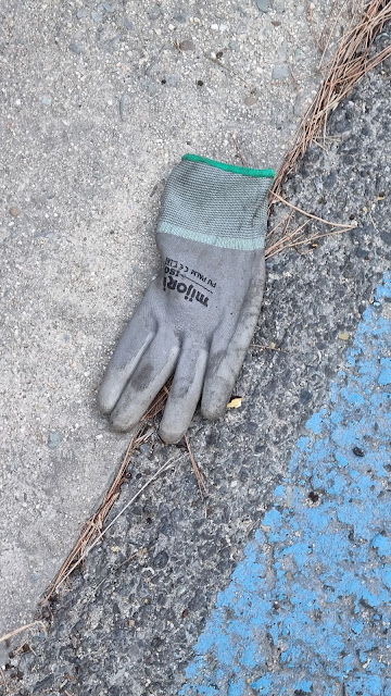
a story of gloves


the village of Angdeok (Angdeok-ni)


a bus-stop pic for the GPS-heads

a pair of abandoned galoshes

10% grade... the hill's gonna make me earn this.

a neighborhood I see on my way up, looking left

even steeper

looking right: fallen (or felled) trees


I'm switchbacking as I ascend. Longer distance but easier slope.

looking back and left at a modern, squarish house

I liked the tiger and dragon images here.


squash flowers

a small, developing squash

a menu for the place across the street... which is closed this early in the morning

One problem with waking up early to walk is that you pass a lot of food establishments, all of them closed. So you learn to rely on convenience stores when you have a food jones, and when you're not in the middle of nowhere... but you quickly discover that, especially in small towns but sometimes even in big cities like Seoul, not all convenience stores are created equal: some, maybe many, are not 24-hour stores. The unreliability of reality in Korea means you have to adopt a "fuzzy," go-with-it mindset that accepts that there are no guarantees in life, and the country is under no obligation to cater to your whims and desires. Quite the opposite: you have to learn to understand and adapt to your surroundings. I'm 55 now, but I'd say that this is part of growing up.

the resto across the street with more or less the same menu

a tombstone

wider shot, showing the tombstone marks a trailhead

rich neighborhood

a run-down storage container...?

a nice, cute little house

a spray of cosmos as I near the top

stop, catch my breath, take photos of Mom's flowers

Not an optical illusion: that's really the top up there.

How many residences surround this courtyard?

a sign for Euibyeong Village (euibyeong/의병 = "righteous army"?)

so close

"Sssh! Quiet. This is a residential area."

more old-school, stairs-outside architecture

dem chickinz

hens, and not a cock among them

High walls are definitely a thing here.

Whew. At the top, and down we go.


peeking sideways as I descend


Sharp curve. [1st line, red font]
Steep-slope area. [2nd line, red font]
Area where deadly accidents happen. [black font, 2 lines]
Bikes must absolutely reduce speed. [large red font, 2 lines]
Yangpyeong County Governor, Yangpyeong Chief of Police [tiny font]

What're these flowers?

possibly Ageratina altissima (white snakeroot) or Eupatorium rugosa, also possibly poisonous

Imagine schussing down this in the winter after a good snow. Not me; I've never been a good skier and, post-stroke, I might as well be handicapped.

Steepening to 12% grade... I'd hate to walk up this side.

I've learned a lot of vocabulary thanks to walking these routes. A naerimak/내리막 is a descent.

The barn/cathedral/chalet thing.

some art, tossed aside, apparently

alert dog sculpture

swooping down to the bottom of this hill

Looking back. That's a fascinating building (barn/cathedral/chalet), and I have no idea what it's for.

leveling out as I approach the river again

The American-seeming neighborhood that weirded me out in 2017 when I passed it and felt transported.

getting close to the bottom of the hill; the slope is flattening out

close to the river

the rich folks like framing their driveways with poetic-looking pines

those cubical Bauhaus houses

nearly at the bottom


There are usually barking dogs at this residence. Maybe they're inside...?


The siding makes me think this house was airlifted here from New England. Residential architecture is all over the place in Korea.


See what I mean about the architecture being all over the place?

This is Gumi-ri, the village of Gumi.

And again! This is somehow sleek yet borderline tacky. The textures and colors don't feel as though they match.


another spray of cosmos

unharvested rice lying flat (after a rain?)

another Gumi Village sign with guardian mini-lions

Ha ha!

Ha yourself!

another bus stop

some artsy-fartsy place called Breathe: café, gallery, etc.


stairs to mystery

a steep road I'm glad not to be on

Korea Rural Development Admin

also Gumi Pumping Station (lettering above the door to the right)

way in the distance, the first daytime glimpse of Ipo Dam (more visible at night when the lights are on)

digital zoom of Ipo Dam

Who's that mirror-curve-fattened fella?

Ambitious vines take over everything.


Our next immediate goal is the Gaegun Leisure Sports Park.

You can see part of the park across the way, but there's no direct bridge there, so we have to follow the land.

more high walls, and a stone lantern/pagoda

Another steep residential street that I wouldn't want to navigate, on foot or in a car, during the winter.

Maybe it's modeled on a sari pagoda. Sari is the relics remaining after a monk's cremation.

I feel lucky to be walking along this level path.

Better than struggling up that canted driveway.

The concrete's been roughened for traction during the winter, but when it's really snowy, it's still slippery.

a more humble-looking, hunkered-down house

the creek that runs by the leisure-sports park

I have to thank my buddy Charles for explaining that the Konglish word leports is something like a portmanteau or polysynthesis for "leisure sports." I'd long wondered what the hell a "leports park" was.

I'm having trouble reading that third syllable. Hajato Village 3?

sorry for the blur

a house on the hill


Gaegun Leports Park, thataway (right)

This way also leads to the Yeoju Dam (which I'll hit on this day) and the Choongju Dam (much farther along).

Having followed and crossed over that creek, we now go down this street to the park's entrance.

"4 Rivers Gukto Jongju, South Han River Bike Path"

So the creek's name is the Hyangni-cheon.

As I pass, I look down at an archery center.

There's the field. Let fly your arrows, men!


We must cross this bridge to enter the park.

I'd never noticed the hanging cow images before. Here's one. Moo.

Here's the other, on the other side of the bridge. This region prides itself on its beef.

That looks suspiciously like the 8-spoked Wheel of the Dharma (Buddha's teaching, in this context; dharma has many other meanings), symbolizing the 8-fold path (right views, right intentions, right speech, right conduct, right livelihood, right effort, right mindfulness, right concentration).

Hajapori Bridge

creek's lookin' a little hairy


the sax player who greets you when you enter; "Gaegun Leports Park," says the plinth

Funky new building that I'll photograph again from behind later.

The tasty bull who guards the toilet.

Foreground: the Gaegun All-purpose Gateball Building
Grrr. Gateball looks a lot like park golf. I am not pleased.

As if one bull weren't enough...

I think this is subtly hinting that people shouldn't smoke.

Deer and cow guard the hangari (large pots, jars, urns, whatever).


I usually flop down and rest here. I didn't stay that long on this day, though. Had to keep moving.

I did take a shameless selfie, though.

I cut across this way and avoid about a few hundred meters of bike path, turn left, and continue.

Just how many sexes are there?


We're going left, but first...

This memorial is fairly recent.

This is now the Monclar Road, named for General Ralph Monclar.

I've never seen a fisherman's tent out in the water that far.

Good luck, buddy.

Onward to Ipo Dam! Another few kilometers.

flowers by the fence

Ipomoea hederacea (ivy-leaved morning glory or Kaladana)

Some sort of Vicia/vetch? I don't know.

Another type of morning glory? Seems so.


I told you I'd take a pic of that funky new building from the back.

I do love dilapidation.

old-school Korean house


a big, fat American-style orb weaver

Hey, there, thicc girl.

the most Korean house ever to Korean

another of so many ubiquitous exercise stations, loaded with machines that are best for old people

I keep thinking this actually says something.

funky blue bench

a classic-looking shwimteo

more rich people

Can you see the dam getting closer in the distance?

rich houses side-by-side with shack-like cafés

I think the place has closed down. The sign is saying thanks for having come by all this time.
UPDATE: Naver Dictionary says hyueop/휴업 refers to a temporary closing. Hyu/휴 means "rest."


the big, calm South Han River

Gukto Jongju; Tangeum-dae, 93K ahead; Paldang Bridge, 43K behind
The mysterious Tangeum-dae is, I think, by Tangeum Lake much farther down.

And what are these?

Euphorbia marginata (Snow-on-the-mountain), I think


You see a lot of this, too: raised earth and back gates leading to the bike path.


puffball tree


The sign advertises Gaegun Grandma's Soondae Soup. (soondae = Korean blood sausage)


as modern and cold as a European art gallery


Is this a one-family residence or a public building?


no gate, but raised earth and stairs to the bike path

nicely landscaped


If that's not a rose, it's a balsamina.

stairs to mystery

There doesn't seem to be much left of what used to be a wall of hangari.


I bet kids would love this sort of arrangement.

Ipo Dam is almost within reach!


a sign about honeybees, I think

1.2K to the Ipo Dam Business Office certification center

Han River Trail Bike Path


going up to an eMart24 convenience store to refuel


I'm being naughty and eating a carby sandwich, as you see through the bag.

There were people sitting in a group here, but they cleared out soon after I arrived. Coincidence?

back on the trail after a munch, a slurp, and some rest

What's that place like during a flood?

And that place?


I'm a bad actor. I was trying to convey dubiousness: the sign behind me says I'm in Yeoju already. Ipo Dam is only about halfway along this segment, though. I guess this is Outer Yeoju.

another mantis, dead

approaching the dam and the place where I fell (hit the link and scroll down a ways)

the certification center

Ipo Dam


There's a whole cluster of these jangseung right before you reach the dam.


I love how some lean drunkenly on each other. Like real Koreans.


Some castle (I think) is 600 m left; the cert center is 200 m right.


elevator shaft for old and handicapped folks but used by the general public


Coffee Mama/Observation Deck

Every dam has its own unique structure and layout.


pointing to where I'd tripped and fallen in August of last year, injuring myself

It says "Ipo Dam" in the foreground. The building says "Ipo Dam Observation Deck."

the gentle descent

14K to the Yeoju Dam cert center, or so this sign claims

building with restaurants and a bikers' shop (buy gloves, helmets, kinky Spandex)

This ramp takes you down toward a campground that had been hit hard during COVID. But it seems to have come back to life, possibly under new management.

This is the Ipo Bridge (이포대교).

Keep going straight.

It says "baseball field," but...

It's full of park golfers! Aaaaaaaaaggggghhhhh!!!

Have I told you how much I just love park golf?

The tour buses are lined up, and they've disgorged a horde of old people.

the tall abstract sculpture that greets all the cars when they pull in

Parking lots have filled up again; I appreciate all the renewed vigor even if it's for something as twisted and misguided as park golf.

not exactly roughing it


tents on platforms... on platforms!

This section is called an 오토캠핑장/Auto kaemping-jang, i.e., an auto campground. To me, it is the antithesis of camping. Most of these "campers" end up setting up their tents on these wooden platforms, one per lot. So your tent isn't even in contact with the ground. A bit like an RV campground in the States, I think these places also supply plugs for electricity. Now, while I appreciate plugs in my motel rooms so I can recharge my phone, I'm old school and have no such expectations when I'm outdoors. The only concession I'll make to this ridiculousness is that it might be fun for little kids. But any adults and older kids who come to such places for anything other than to practice setting up their gear are merely fooling themselves if they think that this is camping. The scorn I heap upon these people—no, the scorn I heap upon the people who created and marketed this abomination—cannot be measured. These "campers" are all poor, deluded victims as far as I'm concerned.

I could rant all day, but I won't. Basically, as my dad used to say, the object of the game, when you survive outdoors, is to keep warm and dry. Everything proceeds logically from that, and you begin to realize how little you actually need to make it in wild conditions. What's the object of the game for people who come to an auto campground? All people did was to drag civilization along with them to what used to be an untrammeled, pristine part of the country.

And don't get me started about "glamping." I mean, seriously—what the fuck?

parked cars and facilities

make it stop

biker asshole straying into the pedestrian lane

My biker coworker used to complain about walkers who would stray into bike lanes. I can absolutely see that happening, and I despise those walkers as much as I despise the bikers who can't respect lane markings. Stay—in—your—goddamn—lane. For others' sakes.

Some tents, here, are thankfully on the ground.

moving away from this campground and enjoying a quiet interlude before the next patch of civilization


They look like miniature daisies, but I think these are first snow heath asters, or Aster ericoides.

"Ipo Dam Auto Campground, 500 m ahead." Oh, goody.

Gonna be a long-ass 500 meters.

the Ong-gi Bridge


nice-looking parking lot, I'll give it that


The sign's explanation of the auto campground is a load of bullshit. It's saying you leave the city, taking along a tent as your house, and you get to enjoy nature. Fuck whoever wrote this tripe. Seriously, fuck them up the ass with a splintery broomstick coated in hot tar. And fire ants.

Why would you want to camp with all these other... people... around you?

bike rental among other things

sorting and collection area for trash

The ramp I go up to get out of here. While I'm happy the place has livened up, I'm not happy with the place.


Yes, Virginia, the South Han River is still technically the Han.

a sign for the Yeoju Riverside Reservoir

one of the biggest drainage gates (baesumun/배수문) I've seen


Namhangang-daegyo, or the South Han River Bridge


the choice

In the image above, I have a choice. The longer way would be to follow the standard bike route to the left. The flat patch of land you see inside the fork in the road used to hold a huge, mountainous pile of earth, but that's all gone, as I noticed last year (I think). Or instead of veering left, I could take a shorter route along that small road that goes straight and hangs by the riverside. I choose to go that way. First time in years that I've done this.

Some bikers also choose this route because they either see me walking this way or already know the shortcut.

home for another Korean Jethro or Clem

I suddenly realized I had to go pee. I was also still farting every several hundred meters.

Someone knows about eggplant emojis.


Oenothera biennis, or evening primrose.


I'case you was wonderin'... we out in the stix, boy.

a type of cosmos


I used zoom because a person was out, and I didn't want to intrude on property.

Shwimteo come in all shapes and sizes.


Squash are hiding here.

See?

squash flower and squash

Don't people use these in salads?

You can run, but you can never hide.


This mini-Hogwarts is a riverside pension.

Cleverly enough, it's called the Ipo Dam Riverside Pension.


I'm still looking for a quiet spot to take a piss.


another richie-rich property

chilies!


How can you not love all the agriculture going on?


This could be the flower of Senecio macroglossus, a creeper.

squash flower doing its Georgia O'Keeffe impression


one busted squash

a busted, bug(?)-covered squash


another resting spot

I did eventually find a place to piss back there. Satisfaction.

And now, after that shortcut detour, we pick up the standard path again.

This straightaway goes on for several kilometers. I hopped from the bike path to the road and back.

This bit of road is where you can often find people parked and doing stuff like flying remote-controlled planes. On this day, a group of people had brought their parrots, which looked gorgeous as they flew, but which gave off a comical-sounding squawk/gurgle/croak. If I'd had my wits about me, I'd have taken video of the birds, but I was getting tired. Sorry for the lack of parrots.

I didn't bother with the unkempt pedestrian path (barely visible at the extreme right). It disappeared, anyway.

"Slow: steep slope"

"Gukto Jongju"


straightaway, straightaway, straightaway


Again on the road. There were occasional cars. I had to move back to the bike path.


One of those mountainous piles of earth used for construction purposes. That one, too, will disappear.


"Gukto Jongju"

Die Maus ist tot.

another tent-y shwimteo

"This place is not for throwing garbage."

But you can see the castaway plastic bottles.

here...

cigarette butts

We love polluters, yes, Precious.

Downtown Yeoju in the distance!

The straightaway ends, and we serve left to the bridge.

We'll turn right, onto the bridge...

...which is called Hupo Bridge.

Allez, on traverse!

another creek buried under verdure


I thought this guy (gal?) was dead. His/her bright colors made me think s/he was poisonous, so I poked him/her with a little stick, which is how I discovered s/he was still alive. But s/he(?) was obviously dying.

the apartments that greet you after you cross the Hupo Bridge

What's going on with this field to my left?

Up the slight hill we go. I don't even count this as a hill.


We're setting ourselves up for the final approach to the Yeoju Dam, the second dam of the day after Ipo.

Dam in the distance... and about now, it started raining. Lightly, but enough for me to wear my jacket.


Mugunghwa! (무궁화, Rose of Sharon, South Korea's national flower)

With my camera up so close, it's hard to see how small this one is.

I can't look away from Yeoju Dam. I like dams and pretty much all Big Engineering.

"Sharp curve—slow."

now crossing the Gasan Bridge (Ga Mountain?)


the ever-noisy creek (or crick, as they say in the sticks)


1.4K to the Yeoju Dam certification center


1K to go


The sign says "Yeoju Dam." That's an old-style rain gauge on top. It looks like an oil drum.

The span across the dam is labeled as a bridge called Gongdo Bridge.

looking down at a path passing under where I am

crossing onto the dam

Paths everywhere... I'd like to picnic here someday... maybe get married at a memorable place like this.


looking right and roughly northwest

looking left and roughly southeast to downtown Yeoju


burd convention


a sample of King Sejong's hunminjeongeum is on the wall

The admin building. As I'll soon discover, the convenience store there is kaput.

a closer look at Sejong's syllables

closer still

almost across

same image on the other side

Crossed.

the dam's workings, visible from the riverbank and the safety of the admin building


I'm sitting on a wooden shwimteo under an eave—a square platform like those ridiculous camping spots I'd passed.

Time to forge ahead. Only about 6K to go to the bus terminal.

Yeoju Dam's certification center

I love how it says "Warning" in English... and the rest is Korean. If you're Korean-illiterate, you're fucked. Basically, it says to avoid the water during severe weather.


"Construction information: ahead 200 m, until July 2026"


some sort of re-landscaping...?

This looks new, interesting, and promising.


Onward I go.


another modern interpretation of a shwimteo


This skier was pretty acrobatic. Again, if I'd had my head screwed on right, I'd have taken a video.

sickly hydrangeas

one healthy bloom among the brown ones

yeesh... summer is over, I guess


click to enlarge and read the explanation


See the dude reclining on the left?


Coming up on the Sejong Bridge... this is the town of King Sejong; he's buried here.

the steps up to Sejong's "forest bathing" path


go right for forest bathing; go left for Yeoju City Hall

I'm going left. The bus terminal is along the same street as City Hall.

past Sejong Bridge

up the slight rise to a major landmark

up, up, up (it's not really that far)

And right before I cross the footbridge...

...that's the 30K mark from Yangpyeong Station.

This is the Hari Footbridge (Hari bodo-gyo) or Hari Sidewalk Bridge.


crossing into downtown Yeoju

but still by the river for now

This mildewy thing has been here for years. I love it.


Flags out in honor of the rapid succession of holidays.


continuing straight on to City Hall, then turning right and walking up to the bus terminal

a Confucian seoweon, I think, seen from the back


The back of City Hall. I pass the building and turn right.

here


and I go straight again


an example of Sejong's hunminjeongeum, another tribute to the great king

At last, I'm at the terminal.

And that's it! I got a ticket from the machine for an express bus to Seoul. The 33K walk took me 11 hours, so that's a pitiful 3 kph, but that figure includes my several rest breaks, so I was probably walking somewhat faster than that. My feet hurt, but not badly enough to need my ibuprofen. I did, however, acquire some pre-blister bruising on my right big toe, and both of my feet were fairly achy. I'd made it up a largish hill, though, and I'd done 69K over two days, so that's a major reason for me to think I'll survive this year's walk just fine.

Thanks for accompanying me on this journey. I look forward to the upcoming walk.

Enjoy the bruised right toe and the irritated left foot.