[Initial post.]
I've now uploaded all the photos from the walk, which took place entirely on Sunday because I left so late. The walk went from 1:05 a.m. Sunday morning to about 8:55 a.m.—late enough for the air to get plenty warm and remind me that summer is still stubbornly holding on. As I continue to update this post, check back periodically over the next day or two to see whether I've added a narrative, added captions, and maybe included some facts and figures.
Naver Map, which likes to change things up, calculated my final distance at only 25 km (using the bike-route calculation). I walked from my place to the usual bus stop in front of Hanam's Starfield department store. 25 km in 7 hours and 50 minutes is rather slow—much slower than my pre-stroke 5 kph pace (i.e., 25 km in 5 hours, no breaks), but if we chop out my rest-break time, which came out to about 42 minutes, then my actual travel time was 7 hours and 8 minutes. That's 3.5 kph. Still lame, but not as lame as it could have been.
Feel free to click on any photo. If you want to see a pic full size, then:
1. Click first to enlarge it (especially true for landscape, but portrait doesn't get much bigger).
2. On the "enlarge" page that appears, right-click on the image.
3. From the menu, select "Open Image in New Tab."
4. Tab over to see the image. If it's not full size, left-click on it.
[Finalized post.]
So! Walking to Hanam City. I obviously made it, so I guess that answers the question of whether I can walk such distances again and live. This week, I'm going to try walking every weekday since we're getting closer to D-Day, October 16. I'll probably walk to Hanam again this coming weekend. I need to know by October 9, a week before departure to Busan, whether I'm capable of walking long distances ("To cancel, or not to cancel?"), so somewhere toward the end of that time period, I need to do a test walk of over 30K per day, two days in a row, to (kind of) settle the can-he-sustain-this-for-days-in-a-row question. (I have a route in mind.)
The walk didn't start off that well, though, which is worrisome. In fact, it followed the pattern of the walks I'd been doing not long before the heart attack: I'd feel some kind of pressure in the chest—which I now know to be angina—after which I'd sit and rest for five minutes. I'd then get up and continue, and there'd be no more chest problems for the rest of the walk. This time around, the same thing happened: angina within ten minutes of starting the walk, a sit on a nearby bench for five or six minutes, then up and walking problem-free. It's close enough to the pre-heart-attack pattern that I'm even considering taking a special trip to the hospital to find out whether I need to scan for either more blockages or for whether either of the 30% occlusions might have occluded further.
Anyway, the rest of the walk was worry-free, but proceeded frustratingly slowly. In my heyday, I was never a fast walker, but 5 kph now seems awfully fast compared to my speed on Sunday. So I was frustrated by my speed, but the boss today reminded me that we have a day off tomorrow and another day off this Thursday, so there are opportunities for me to walk to Hanam again and work on improving my speed. I hope it's just a matter of getting back into a routine, and realistically, I'm not looking to get back to 5 kph at all; the stroke took that out of me three years ago. So 4-point-something kph will do fine. Being in the 3-point-something zone is ridiculous: before the stroke, I would walk that slowly only in the final days of a trans-Korea trek, and usually while encumbered.
The problem that began to dog me during this walk was achy feet—a sign that I had lost some of my conditioning. The ache wasn't debilitating, but it's possible that it may have contributed to my slowing down. As my heart, lungs, and feet become more robust and find themselves again, the situation ought to improve. The one big (biggish) hill on this walk proved tiring, but it didn't evoke any further angina. And I have no blisters or irritations.
I ended up taking five rest stops: 6 minutes, 6 minutes, 10 minutes, 10 minutes, and 10 minutes. 42 minutes in all. I doubt I'll get that down to zero stops by October 9, but I'm more worried about my walking speed. As the weather continues to cool down, though, I think that lower temperatures might help spur me to walk faster. As things were, it was mostly a nighttime walk, and temperatures were quite pleasant. There was some sweating, especially after the one hill, but nothing else bothersome. I'd brought a windbreaker but never needed it.
Below is a rare pic from close to my apartment: a well-lit, under-the-bridge shot showing life for some construction workers to use the space under the bridge as a base to store material. Normally, that entire area is dark:
 |
| This off-ramp often protects me a bit from rain. |
 |
| Tan Creek. The bright star is Jupiter, eastern sky. You see Lotte World Tower in the distance. |
 |
| My first time walking this far to the Tan/Han confluence since the hospital. About 5 km in. |
 |
| The slope where the Tan Creek's water gets a final aeration before dumping into the Han River. |
 |
| The Han River Park has really become, over the past several years, a favorite spot for sculpture displays. Megakitty. |
 |
Sculptures—some visible, some less so. I decided to do a detour and photograph them all.
(This was my second six-minute "break.") |
 |
| Sing it, Harambe! |
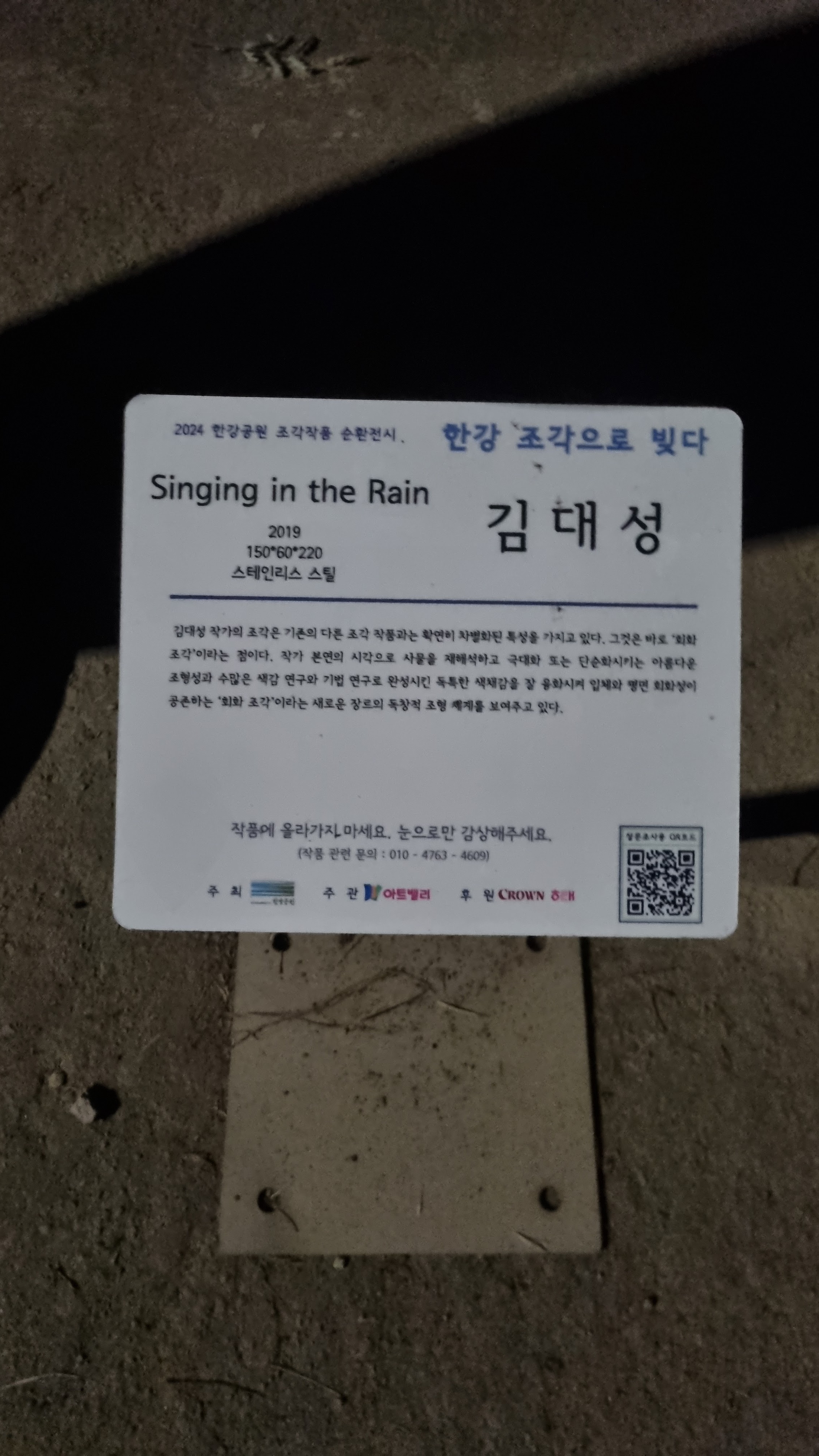
 |
| I should've looked at the title. |
 |
| Except for the balloons, this looked like school or office supplies to me. |
 |
| A face made of pipes. I like it and want it. |
 |
| The face is called "No War." |
 |
| escapee from a Star Wars film (or from "Interstellar") |
 |
| wiry burd |
 |
| with flash (I used the flash several times, as you'll see) |
 |
| howling wolf? |
 |
| serene face |
 |
| funky family |
 |
| "The Aristocrats!" |
 |
| Mom's gettin' into it. |
 |
| Minecraft refugee |
 |
| more blocky people |
 |
| Oh, to be that happy and carefree. |
 |
| I guess the one on the right is female. Beeeewwwwbs. |
 |
| I hope the dog is friendly. |
 |
| I'm sure I've seen this pig-with-a-city-on-its-back before. Sculpture gets around. (See this from 2 years ago.) |
 |
| happy dawg |
 |
| a rather uninspired bouquet |
 |
| This piece is titled "Gobot." |
 |
| What's this? Etwas normales? |
 |
| Buffalo, as processed through a Halo game. |
 |
| Begging, or bringing over Starbucks? |
 |
| little girl, a-strummin' |
 |
| up close |
 |
| simply titled "Bull" |
 |
| with flash |
 |
| strangely evokes a cactus |
 |
| the woven horse |
 |
| different angle |
 |
| not exciting, but another in the genre of "Little Prince" sculptures (St. Exupéry's story is popular story here) |
 |
| rabbit in nightgown |
 |
| ...and that's the title. |
 |
| back on mission, approaching Jamshil Bridge |
At about this point, I did briefly think about turning back at Jamshil Bridge and just doing 14K. But that was the tempting voice of laziness talking; I ignored it.
 |
| straightaway, with Lotte World Tower |
 |
| Jamshil Bridge, up ahead, marks the 7K point. Every kilometer felt long. Been a while since I'd done this course. |
 |
| A full marathon is 42.2 km (26.2 miles). Is a half-marathon really 16 km? Or is this just the 16K point? |
 |
| sign for the Olympic Bridge |
 |
| crossing under |
 |
| I'm still in love with the cathedral-like effect of bridge architecture. |
 |
| looking back at the Olympic Bridge from a distance... still looks vaguely Soviet |
 |
| onward |
It was a quiet night, but well lit, with some walkers and a lot more bikers. Fair-weather pussies, but I might owe those pussies my life were I to collapse and need CPR again.
 |
| This construction was new to me. |
 |
| A sign explaining this is about sewage-pipe maintenance. |
 |
| Danger Guys star in "Careful about bumping into people!" |
 |
| the Rose of Sharon park |
 |
| Korea's national flower. Here are some white ones. |
 |
| White flowers matter. |
 |
| the bridge at the 10K point |
There's a 24-hour convenience store that I stop at at this point. Got myself a diet drink, a hot-dog-on-a-stick, and a fruit cup of large seedless grapes (carby, I admit). The grapes cost W8000, striking me as incredibly expensive. Sat for ten minutes.
 |
| 보행로/bohaeng-no means "walking path" or "pedestrian lane" |
 |
| the BMX area as we leave the 10K point |
 |
| An important set of signs is coming up. |
 |
(brown sign) Hanam City limits: 7.25 km
Gangdong Bridge 4.95 km
(blue sign) 4 Rivers National Trail
toward the South Han River Bike Path
Paldang ridge 15.7 km
My destination was almost the same distance away as the bridge. |
 |
| Thus began the rosy part of my walk. These have been here since spring, suffering through summer. |
 |
| lookin' beautiful, but rough |
 |
| I remember walking past all the construction as the fencing and arches were set up. |
 |
| Too bad Bill Keezer is no longer alive to appreciate these. |
 |
| For you, Bill. Enjoy, wherever you are. |
 |
| Sorry. I didn't notice this blur when I took the pic. Anyway, this is the next phase of the walk. |
 |
| A fast old couple. It's around 3 a.m., and the old people can't sleep, so they go do healthy things like walk. |
 |
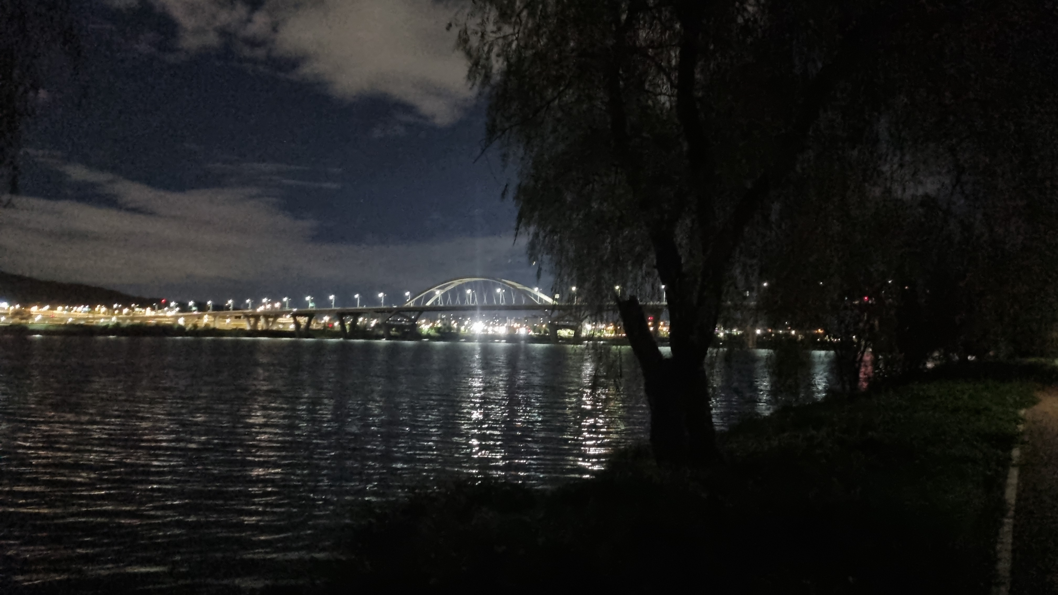
| something hypnotic about this bridge |
At this point, I'm coming up on the path's lone hill. The first time I did this hill, I was fooled by the optical illusion that I had reached the top when, in fact, the hill's seeming level ground was merely hiding more hill. I know this hill's tricks now, though, so I'm no longer as perturbed as I'd been that first time. A lot of hills fool you this way, so you learn to accept that the hill's not done until you are definitively at its inflection point.
 |
| We start with a gentle rise. |
 |
| I love Danger Guy's pose. |
 |
| Up and up we go. |
 |
| First optical illusion. About a meter or two vertically down (and back) from here, and you think you're done. |
 |
| Danger Man, not as covered by plants |
 |
| I stuck my camera through some fencing to get a shot of the sheer slope. |
 |
| nearing the top, but pedestrians go left to the steeper route |
 |
| Ipomoeia, or Morning Glory |
 |
| I hope the different colors get along. |
 |
| starting down now |
 |
| hints of sunrise beyond the Godeok Bridge |
 |
| 8.3% grade down; red sign says (columns read right to left), "Frequent accident area. Slow." |
 |
| la paroi, la muraille, l'enceinte (maybe not that last one, which is more of a surrounding wall) |
 |
| following the wall down, toward a dawn sky |
 |
| See the slice of moon? |
 |
| Godeok District Eco Landscape Conservation Area |
 |
| leveled off and moving on |
 |
| not much longer until we start moving away from traffic |
 |
| Here we go: what I call the "fairy lights" bridge. The bike-symbol sign says, "Construction: bikes, slow." |
 |
| Damn. Lights are on, but not the cute little fairy lights. |
 |
| Godeok Stream (Bridge) |
 |
| the quaint straightaway that always reminds me of a tree-lined, European lane |
 |
| I think this marking lies: "Hanam City Limits, 0.9 km." Seemed farther. |
 |
| definitely morning |
 |
| coming up on another important sign |
 |
4 Rivers National Trail
toward South Han River Bike Path
Paldang Bridge: 9.7 km |
 |
| Do you see the people playing morning tennis? |
 |
Like the guys compelled to snap photos between girls' legs, I love my between-bridges pics.
That's probably the city of Guri in the distance, beyond the Han's north bank.
|
 |
| Burd silhouette made by vines? |
 |
| I stopped and rested here about ten minutes. Checked distance: I'd come 17 km. New record. 8 or 9 km to go. |
 |
| At the 17K point. The bags under my eyes get ever larger as I age. |
 |
| And onward we go. |
 |
| I believe I'm looking right at Hanam City. We're not in it yet, but there it is. |
 |
등나무집/deung-namu-jip, according to Google Translate, could mean "Wisteria House." The menu advertises maeun-tang (spicy seafood stew), grilled eel, chicken stew, eel soup-and-rice, noodles, etc. |
 |
That sky! But as Sting sang, "Heavy cloud, but no rain."
|
 |
| rest stop up ahead, which I did not use |
 |
| What's going on down there? |
 |
| I imagine that's a café or restaurant. Or a café-restaurant. |
 |
| The first mature Joro spider I see looks to be weak-legged and dying. Alas. |
 |
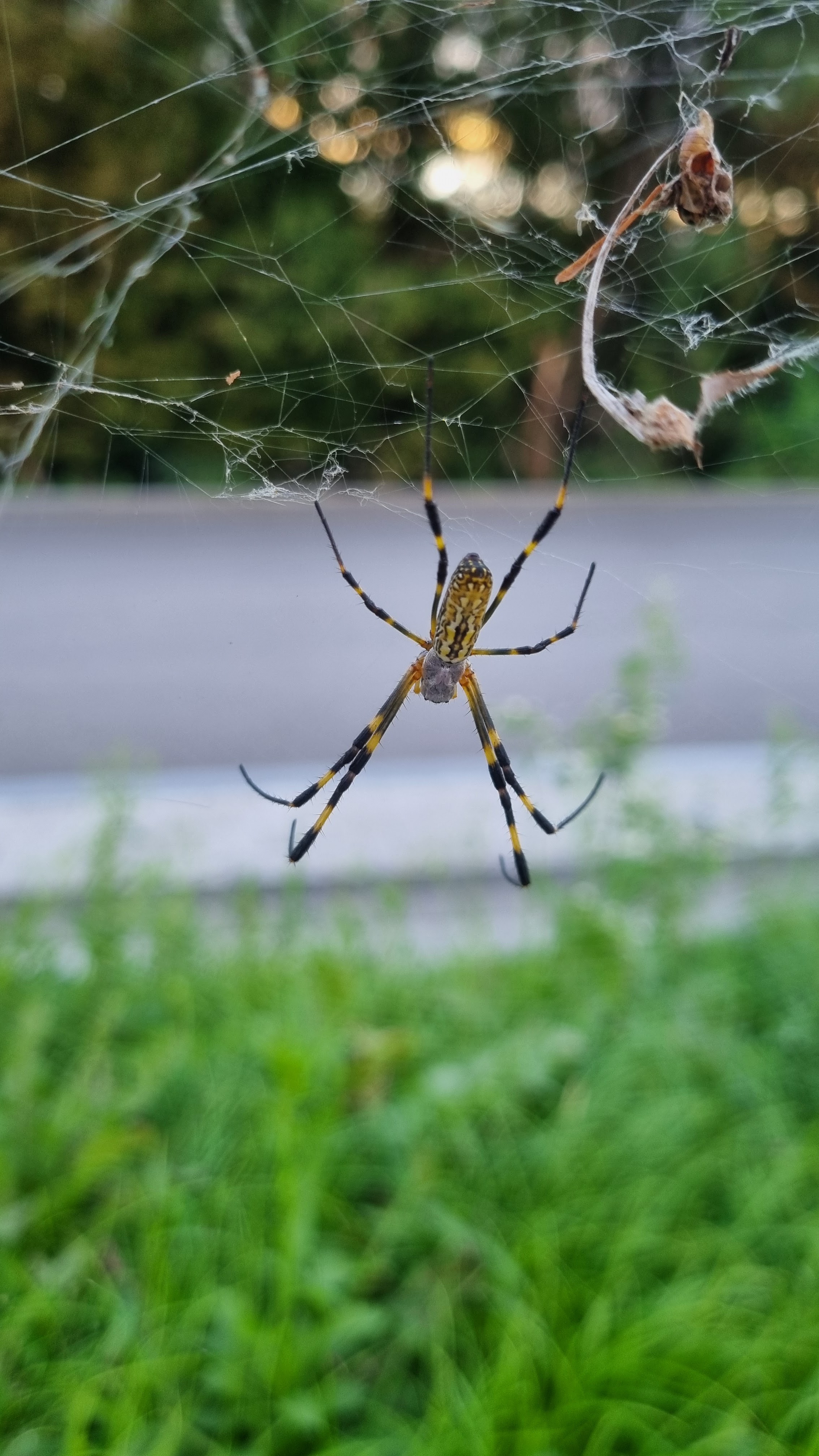
| Digital zoom to catch this one, which was in the distance and looking strong. |
 |
| And another! They're coming fast and furious now. |
 |
| first glimpse of the Hanam City limit (digitally zoomed) |
 |
| The approach... this felt way longer than the stated 900 meters. |
 |
foreground: a sign about water-resource protection
green sign: Hanam to the left (forward/east), Seoul to the right (backward/west) |
 |
| One of the slim, athletic girls who works out like a madwoman. |
 |
left post: "Eco-friendly City, Hanam"
right post: "Migratory-bird Habitat, Hanam" |
 |
| I never usually photograph this pole, but the wires were making weird boinging and pinging noises. |
 |
| The big straightaway, and we're well away from all traffic out here. |
 |
| dem droopy trees |
 |
| Brightening sky, Misa Bridge up ahead. Cross under that and start looking for a right turn. |

The pic below is significant for the open gate in the white fence. Some background: the final part of the walk, about 5K, involves breaking off from the path (see two previous photos) and going up a berm to a packed-earth path that goes on for about 4 of the final 5 km. Last time I came here, earlier this year and before all the heart-attack shit, I thought this turnoff had been fenced closed, so I muttered "Fuck" and went up the ramp used by bikers ascending to the eastbound lane. The ramp went about halfway up the incline, then there were stairs to the top of the berm. This time around, I said "Fuck" again when I saw the fence, but my vision cleared, and I noticed the open gate. "Oh," I said, bemused. And up I went. I wish these wide concrete staircases had banisters/balustrades; my balance has been a little shot since the stroke, so I no longer enjoy going upstairs without the help of a railing. Still, I managed the climb and got to the top of the berm, where I found a bench and took my fifth and final rest break, drinking down the rest of the 500-ml water I'd brought with me. I knew there'd be a water fountain at the end of the dirt path, though, so I felt free to guzzle now as opposed to waiting.
 |
| See the open gate in the white fence? I came up through that. Didn't see it last time. Maybe it'd been closed. |
The packed-earth path at the top of the berm had had an addition put in: a sandy lane for barefoot walkers. Koreans are into the reflexological principle that stimulating your feet through barefoot walking on sandy or round-pebbled surfaces is therapeutic, encouraging circulation and such. I'm not a fan because it's a bitch to clean your feet afterward, and I'm enough of a messy Westerner that I know I'd never clean my feet thoroughly enough, leaving me with painful grit once I'd put my socks back on. One thing I began to notice, though, was that a lot of barefooters would take their shoes off and, instead of walking in the middle of the sandy lane, walk on the hard-packed earth right next to the sandy lane. Why they did this was a mystery to me, and it seemed like a waste of the efforts of the construction guys who had created the lane earlier this year (see this post from July, a month before my disaster, and be sure to scroll way down).
 |
| Physostegia virginiana (Fall Obedient Plant) |
 |
| I should've straightened the image alignment. |
 |
| A biker races eastward below the top of the berm. Lots of bikers in the mid-morning. |
 |
Guri Deokso in the distance |
 |
| And the sun is out and over the mountains. The air's getting warmer, too. |
 |
| fence shadows at play |
 |
| looking right, toward Hanam |
 |
| a map for Hanam Wirye Road |
 |
| the metal mushrooms! |
 |
| farming on the outskirts of Hanam |
 |
| Gaura lindheimeri (Whirling Butterflies) |
 |
| people, with nature as a vast backdrop |
 |
| After going straight a while, the path curves, indicating the fun's about to end, and it's time for the next phase. |
 |
observation deck to the right, Guri in the distance
looking westward over Misari rowing lake, toward part of Hanam |
 |
| another observation deck, with burdz eternally frozen |
 |
| that nifty park I should visit |
 |
| You can see the tall tower that is one of Hanam's big landmarks as the curve takes us to the end. |
 |
| This food-stand stuff is new to me. |
 |
| At last—the watering hole. A quick refill and guzzle, then a pit stop at the restroom. |
 |
| Slurrrrp. |
I'd been one farty son of a bitch during the entire walk, but by the end, I still didn't need to take a shit. With more people around me, though, I had to think more strategically when releasing my gas. Clever little Kevinses, yes, Precious.
 |
| Note the walking route down and across that little creek. There's a ramp I go up on the other side. |
 |
| Down this ramp we go. |
 |
| And now, we go across. See the ramp leading right? |
 |
| a better shot |
 |
| Up the ramp we go—our last uphill. |
 |
| the tantalizing shot of the Starfield department-store sign |
 |
| around the side of Starfield to reach the bus stop at the store's front |
 |
| It's a cute, little lover's lane, good for a short stroll. |
 |
| Shinsegae, one of the more famous stores at Starfield |
 |
| that abstract sculpture |
 |
| And here we are at the "bus drop." Done. |
 |
| 9303, 9303-1, and 9302 all go to Jamshil. |
And we end with one final selfie:
In all, it was a good walk. As a "proof of concept" for whether I'm back to being able to do my usual distances, my conclusion is that I can, but I need to work on speed, vigor, etc. This isn't too urgent given the number of extra rest days I've programmed into the long walk (i.e., I can afford to arrive late at a given destination if I know I'm going to be staying an extra night), but I'd still prefer to walk more strongly than to limp along like a diseased old man. I'm old, yes, but I'm not that old, and I don't want my condition to defeat or define me. And again: if I do croak on this long walk, well, I'll at least have died doing something I love.
I'm still not definite as to whether I'm canceling. I'll give you official word on October 9 or 10. Let's keep doing practice walks and get working on some stairs.


That hill is known colloquially as the 아이유고개 presumably because it resembles the curves on her body. Still, the equivalent hill on the North side of the river is far steeper, although last time I went that way, they were doing construction; hopefully to make it safer. As a cyclist, it is typical to cycle out on one side of the river and back on the other in a loop. Are you never tempted to explore the North side of the river?
ReplyDeleteFYI: A couple of suggested amendments to your captions:
1. The photo captioned: "Guri in the distance" actually shows Deokso.
2. The photo captioned: "observation deck to the right, Guri in the distance" is actually looking westward over Misari rowing lake and the buildings are part of Hanam.
Corrections made. The first one was because I didn't know any better: I thought it was all Guri. The second one was... I don't even know. I looked at that photo again and remember quite consciously taking the pic while looking toward Hanam. It's a rowing lake, you say? They don't race motorboats there?
ReplyDeleteI'll make the same corrections to the post on the main blog. Thanks. And I'll study a map more closely so I know where Deokseo begins and ends.
Deokso basically begins at the driving range signified by the green net. It is separated from Guri by a small channel and a big hill, and administratively is part of Namyangju. The rowing lake was, I assume, originally built to host the rowing events for the '88 Olympics. I've seen people rowing on it before (quads or eights), but I don't know what else they use it for. I cycled that way today. From my house to Paldang Bridge, cross the river and back is a nice round 100km, which I knocked off today in a shade over 4 hours.
ReplyDeleteWish I could walk that fast. I also corrected "Deokseo" to "Deokso." Ah, senility.
ReplyDelete