Over the past weekend, I did a major test walk: two days in a row, both days over 30K in length (35-36K and 33K), a big if not huge hill on the second day, and a backpack on my back, packed with about 95% of the gear I'd normally take on a long walk that involved no camping. That's about as good of a simulation of real trail conditions as I'm likely to get (there was even some rain on the second day!), and I have a massive, two-part photo essay that at least partly documents the adventure. This entry is for Day 1, a.k.a. Saturday, October 5. The Day 2 entry for Sunday, October 6 is coming. That entry (or a separate one) will include a discussion of whether I feel I'm in good enough shape for the trail.
To recap: this was a 68- or 69-kilometer walk from Hanam to Yangpyeong, then from Yangpyeong to Yeoju, two of my favorite segments along the Four Rivers trail, which goes from Incheon all the way down to Busan (633K total). I felt a pang when I realized my timing had been a bit wrong: today, Wednesday the 9th, is Hangeul Day, the day South Korea celebrates Great King Sejong's development of the alphabet that revolutionized knowledge and communication on the Korean peninsula, democratizing information and empowering the baekseong-deul/백성들, i.e., the people... and Yeoju City is where King Sejong is buried, and where hangeul is quietly celebrated all year round. But maybe God will forgive me; from the cosmic perspective, does being off by 48 hours matter that much?
As with a regular walk-blog post, we start with an overhead look at my route, which will be easier to decipher if you read Korean. The plot goes from Hanam City Hall Station, where I popped out at street level at almost exactly 6:40 a.m. after training there from Daecheong Station. During the first 2 or 3 km of walking, I stupidly managed to walk off my plotted route and had to get back on it, which meant adding, oh, an extra kilometer to my walk. It's at times like these that I'm glad I normally walk alone: I can make my mistakes and not worry about being judged or given the stink-eye by my travel companion. Anyway, in my view, this deviation wasn't tragically huge, and going an extra kilometer at the beginning of a long walk is way better than losing your way toward the end, when you're tired as hell and possibly looking for an excuse to give up.
That map:
 |
| in principle, 35K |
Next up are my walk stats from my pedometer. The day's total includes the few hundred steps down to Daecheong Station, where I got on the subway, then another few hundred steps for my two transfers and the final exit out of Hanam City Hall to the street level. And as I've said many times before, you can ignore the distance measurement; my pedometer can't be trusted when it comes to distance: I say this walk was closer to 36K; the pedometer claims 44.2K, an exaggeration of 23%. But hey, I'll keep those calorie stats: I assume they're activity calories and not total calories because there's no way in hell that I walked 36K and burned only 2,000 calories above my BMR. So my total burned calories for the day, not shown below, would have been flirting with 6,000. Gotta put everything in perspective.

Unlike my regular walk-blog posts, I'm not putting up ten photos at the beginning before giving you the full photo gallery. Why? Because I'd already done the ten-photo thing during the walk itself on my main blog (here and here). So let's get into this. Follow the bouncing captions.
 |
| a poem (titled "Pocket"...?) at Daecheong Station, seen while I waited for the Line 3 train |
 |
| popping out at street level from Hanam City Hall Station, cloudy morning, about 6:40 a.m. |
I had made a command decision to save money by not training to Hanam the night before and staying overnight in a motel. Hanam is the first city (south of the Han River) that's to the east of Seoul; being right next door, Hanam was close enough that there seemed to be no point in spending money on a motel. I paid the price, though—the advantage of a motel would have been a much earlier start time on the trail. You need to understand that, for me, a 6:40 a.m. start is at least an hour late. The sun's already up, people have been out since 4:30 if not before, and the world is past waking up. In a population-dense city like Seoul, 6:40 is technically the early part of rush hour, and the streets are filled with cars. Hanam isn't quite that bad, but there's still plenty of traffic. Anyway, I was acutely conscious of my lateness as I headed out.
 |
| The very first part of the walk takes me past a park. |
 |
| skirting the outside of the park as I walk toward Paldang Bridge |
I don't feel the walk has begun in earnest until I'm crossing the Paldang Bridge to the other side of the Han. But as you'll see, I get a bit turned around despite marching out confidently and (foolishly) relying on muscle memory.
The backpack on my back has only a few kilos in it. I get used to it pretty quickly.
 |
| a glance leftward |
 |
Hanam Arts Center. Maybe I should visit sometime. Concerts. Theater. The gold-font Korean above the English says "Hanam Cultural Arts Center," but the gray-font Korean underneath says something more: "Hanam History Museum." |
 |
| that big slab of an apartment building |
Being a satellite of Seoul, Hanam is highly residential, and many who live here commute to Seoul for work. Lots of cities to the south of Seoul are no different: Suji, Suwon, Anyang, Ansan, etc. To use a grisly metaphor, if Seoul is a tumor, these are its metastases, supplying the main tumor with needed blood and nutrition.
 |
| You'll have noted that I'm walking generally east, toward the rising sun. |
 |
That landmark tower (Hanam Union Tower) in the distance... I felt oriented.
NB: if "the Orient" means the east, then being disoriented means being unable to find east. |
 |
| lovely flowers on a bridge |
 |
| wide shot |
 |
| passing in front of Starfield and the bus stop where I normally stop after the 26K trek from my place |
 |
| This is where things started to get dicey. I still trusted my muscle memory at this point. |
 |
| Beautiful... but things have started to go wrong without my having realized it. |
 |
| same scene but with the camera tilted down a bit |
By this point, I knew I'd gone off the plotted trail. I should have looked down at my phone more often, but I think pride got the better of me, and I thought I knew the way. The male's famous last words, as any wife or girlfriend can attest.
 |
| irritated, and working my way back to the proper path |
 |
| On track now, but this wasn't the route I'd wanted. Paldang Bridge approaches. |
What I had hoped to do, during these first couple of kilometers, was to approach Paldang Bridge from street level, not descend to river level. There's a way to do that, to take the high road, but I hadn't found it this time, and I ended up eating humble pie, descending to creek/river level, walking under and past Paldang Bridge, then up the bikers' ramp to reach the bridge itself. It's a bit like one of those "jug handle" left turns in New Jersey, where you turn right off a ramp that loops around and shoots you left. Walk past Paldang Bridge, then take the ramp, loop back around, and cross the bridge. The place I'd wanted to hit was at the top of the ramp, thus obviating the need to do all this ramp-ascension. Damn. Next time, I'll get it right.
 |
| about to cross under the bridge, ramp soon to be visible |
 |
| almost a kilometer of engineering |
 |
The pillars for New Paldang Bridge are being built; the span ought to be ready by 2026. The smaller bridge seems to be for bikers and pedestrians. I might still prefer to cross the majestic Paldang. |
I've crossed under the bridge and turned right. The ramp leads up:
 |
| The ramp goes up for a while, curving around and back to the bridge. It's not that steep of a slope. |
 |
| getting closer to the bridge I'll be crossing |
 |
| almost there |
 |
| well, hello, Madame Two Missing Legs |
 |
| pollution, but artfully posed |
 |
| I'd had it in my head that the Paldang Bridge was 980 m. Nerp. |
 |
| But where is Danger Guy in this picture? Already in the drink while his bike teeters on the edge? |
 |
| Crossing. I like the windiness. It's a high bridge and almost always windy. |
 |
| If I'm alive in 2026, I'll be curious to see the final product. |
 |
| the ramp down |
Little did I know that New Paldang Bridge represented only the first of many changes I would see along today's walk. I must say, though: despite the sun, I was glad of the morning coolness.
 |
| another longing look back |
 |
| damn, that's a long ramp down... or up |
In the above photo, you see two bikers going down (or up) a ramp that's totally new to me. Must've been constructed over the past year. Much of this part of the path has been walled off since forever, obscuring one's view and hiding what the little elves are making.
 |
| See what I mean by "walled off"? |
 |
| The road goes ever on and on. |
 |
| cutesy photo-op site for dates... but it gets worse |
 |
| plastic flowers, one with its side eaten off |
 |
| It looks to be screaming. |
 |
| the majestic Han, soon to split into the North and South Han (or converge, depending on your direction of travel) |
 |
And here's that other, truly awful photo-op zone: the angel wings. Pose your girlfriend there, take a picture, and preserve her forever as your little angel (until you break up with her, look at the photo, and realize you were photographing Lucifer). I saw this zone, and the rebel in me came out. |
 |
| the Fat Thor impression |
 |
| Those vines eventually cover everything in a carpet of sinister verdure. |
 |
| There will soon be a left turn away from traffic and into the quiet. |
 |
| Chungju Dam, 134.5K hence |
 |
| left turn coming up |
 |
| across we go |
 |
| Too bad it's too early to stop by this bagel shop. I wonder whether it's any good. |
 |
| the Pride Stairs |
 |
| a sign says Paldang Dam is ahead |
 |
| Lots of bikers in pelotons—the story of today. Tons of bikers. |
 |
| Lots of Joro spiders, too. They've migrated to the States, I hear. |
 |
| As always, many bikers are assholes who stray into the pedestrian lanes. |
 |
| Is something medieval going on, here? |
 |
| What's up with these spears? |
 |
| another missus missing a leg (and a smaller male with her, I think) |
 |
| a rest stop (shwimteo) |
 |
| a glimpse of Paldang Dam |
 |
| There were plenty of pedestrians as well. |
 |
| Korean water power and nuclear power, says the blue-lettered sign |
 |
| first tunnel of the day, taking us past the dam but not down to it |
 |
| ...and out the other side |
 |
The sign for the new Bonjour restaurant/lounge/facility. Hangeul is a terrible alphabet for trying to render French sounds, especially French nasal vowels like the "on" in Bonjour. The closest hangeul can get to a nasal vowel is to add an "ng" sound after the vowel. So in the sign above, Bonjour is hangeulized as bong-ju-reu. When I was in the Tessin/Ticino region of Switzerland in the early 90s with some high-school kids, our tour-bus driver was Tessinois ("TESS-een-wah"), and he spoke French with a heavy Italian accent that actually comes close to Korean renderings of French. So hangeulized French is good preparation for Tessinois French. |
 |
| the back of Paldang Dam, which I don't think I've ever photographed before |
 |
| Ah, Bonjour! |
 |
| backwards to us, but forwards for the benefit of the patrons |
 |
| I've never seen these fountains before. Are they new, or have they been here the whole time? |
 |
| Bonjour, old establishment |
 |
| the fungus-covered log |
 |
| Mom's flower (cosmos) |
 |
| farm life: at-scale greenhouses |
 |
| We must be approaching Neungnae Station. |
 |
| I need to visit Rabbit Island at some point. But when? |
 |
| Dilapidation attracts me. |
 |
| Neungnae Station certification center, 50 m ahead |
 |
| the cert center that I haven't used since 2017 |
 |
| bike-rental spot... many of these along the trail |
 |
the actual, old Neungnae Station, a train station
neungnae (陵內/능내) = inside the burial mound (tumulus) |
 |
| Physostegia virginiana (Fall obedient plant, False Dragonhead, Virginia Lionsheart) |
 |
| We've never left the river. |
 |
| Okay, maybe we're leaving it a bit now. |
 |
| fall garden, with cabbage |
 |
| Both 봉나무/bongnamu and 오디/odi are listed as mulberry... pleonasm? Anyway, a mulberry farm. |
 |
| old and busted |
 |
| On the other side of the shwimteo, too... vandalism? |
 |
| the tiny one is either offspring or the male |
 |
Namyangju Jo-an 2-li (2nd Village) [center-column, large-font text]
"Crime-free village, Jo-an Elementary School)" [small-font text, flanking columns]
[R to L vertical columns, bottom] Jo-dong, Banga Bridge, Rural Village
*The banga mentioned above could be "grist mill," as in the expression 방앗간/방아간. |
 |
| "Yard Farm"? Wassat mean? Anyway, it's a rural village for urban folk to experience farm life. |
 |
| a type of cosmos |
 |
| up to the bridge we go |
 |
| We're heading straight toward Ipo Dam (which we'll see the following day). 6% grade for 50 m. |
 |
| looking right |
 |
| I always photograph Rango. |
 |
| The blue circle says, "Yangpyeong Travel." The swooshes say, roughly, "Where the feet go, the heart goes." |
 |
| the old, converted rail bridge |
 |
| looking right and back |
 |
| the rail bridge's remaining superstructure |
 |
| "Don't lean on the railing; danger of falling." |
 |
| a non-bullet train—a subway, in fact, given all the doors on each car |
 |
| Korail train on parallel track |
 |
| guys in recumbent bikes with aerodynamic shells for greater speed |
 |
| looking right and down at the nearing shore/bank |
 |
| "Greetings!" says the column |
 |
| The yellow sign reminds us: helmets for bikers, belts for car passengers. |
 |
| The shell guys have stopped. I walk on past. They'll catch me much later. |
 |
| Yangsu Station, 1 km ahead |
 |
| What event is this? |
 |
| See the spider? |
 |
| Let me help you to see it. |
 |
| I always look over at this town that I'm always skipping past. |
 |
| same sign about leaning and falling |
 |
| 'nuther subway |
 |
| This approach to Yangsu Station has been nicely paved. I appreciate separating the walkers and bikers. |
 |
| coming up to le rond point |
 |
| roundabout, traffic circle, rond point |
 |
| Yangsu Station, a major landmark—the 17K mark, or close to halfway |
 |
| the GS25 convenience store I always visit... I tried to behave myself this time with nuts and low-sugar drinks |
 |
| Nowhere to sit back there, so I move onward to an empty spot. |
 |
| A train tunnel appears. With a train. |
 |
| Can you see it? It's getting closer. |
 |
| Gotcha! It looks to be a KTX bullet train. |
 |
| "Throw not thy dross in this place!" |
 |
| The trail by the train tunnel, and we have our own tunnel. Second one, finally. |
 |
The yellow sign warns to remove your sunglasses in the tunnel.
The white sign, with red letters, warns of possible falling rocks in front of the tunnel. |
 |
| In the distance, the sign says this is the Yongdam (Art) Tunnel. |
 |
| No art. Fuckers. |
 |
| Peace and quiet. Very little traffic noise. |
 |
| The tunnels come more frequently now. |
 |
| Third tunnel: the Buyong Tunnel 4. |
 |
| riverside traffic, but not bad at this time of day (1 p.m.) |
 |
| Fourth tunnel: Buyong Tunnel 3 |
 |
| another train tunnel... always Freudian |
 |
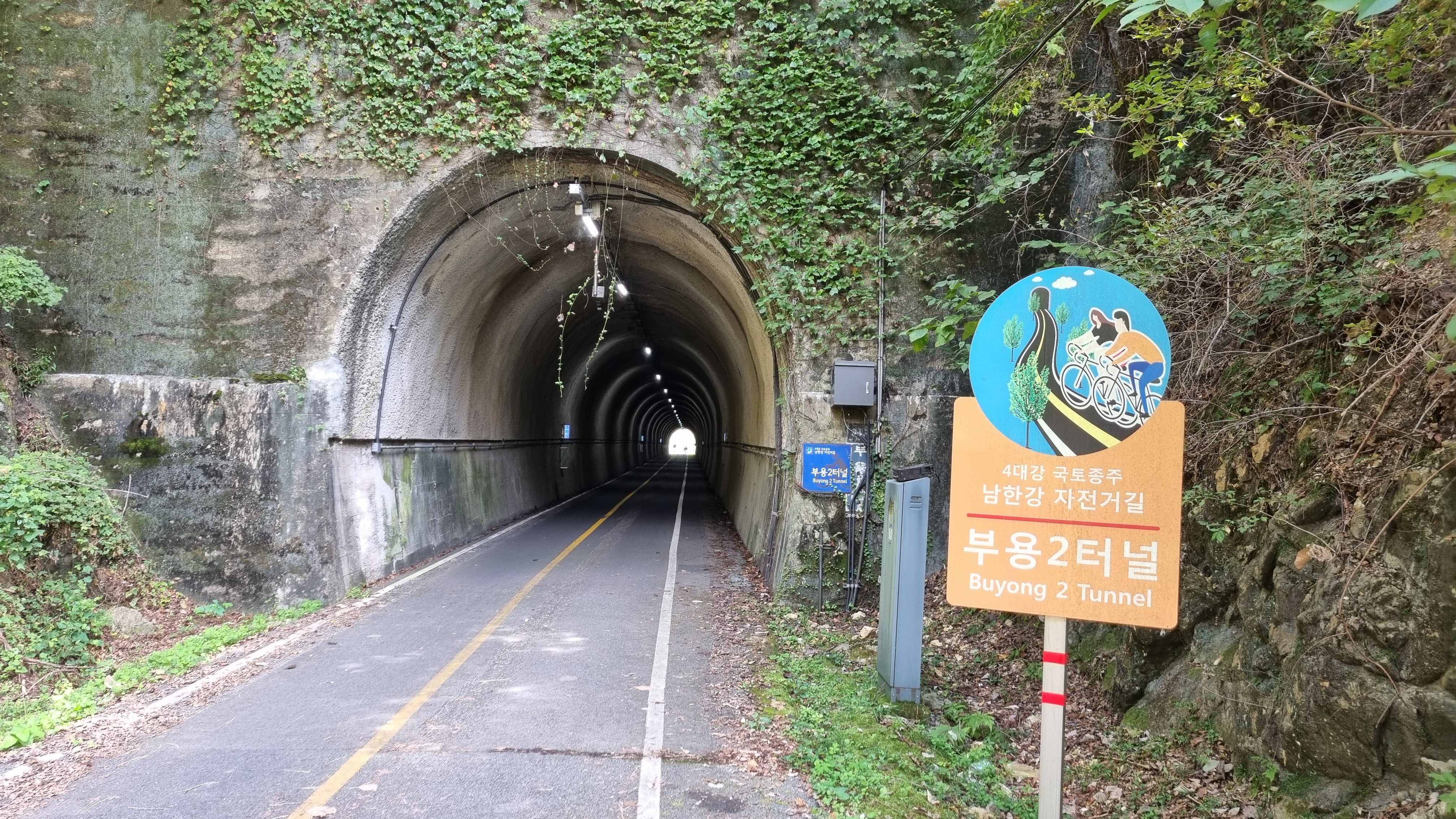
| Fifth tunnel: Buyong Tunnel 2 |
 |
| This spider was doing a Shelob, spinning and wrapping its prey in silk. |
 |
| lots of these little guardian demons |
I've mentioned it before, but I think, with all the peninsular creatures that have awesome color schemes here, it'd been interesting to see Buddhist monks' robes that reflected local nature: Joro-spider-colored robes, ggachi (magpie)-colored robes, etc.
 |
| Sixth tunnel: Buyong Tunnel 1. We have a few more tunnels to go. |
 |
| At 116 m, this tunnel is fairly short, but it's cool like all the others. A relief from the harsh sunlight. |
 |
| Imagine dragons. These are far off, flanking a part of the riverside highway. |
 |
| a wider shot |
 |
| Why am I thinking, "Hi-ho, Kermit the Frog here!"? |
 |
| The orb in the dragon's mouth is a yeouiju jewel, but I like to imagine it's a Lindor truffle. |
 |
| One of the shwimteo over which I'm always obsessing. This one has people. |
 |
| I see that this area got fully developed finally. How weird to see a shwimteo with a swinging chair. |
 |
| wide shot: shwimteo, tent/tarp/pavilion with tables and chairs, and a shop/resto |
 |
| As always, I'm love with the agriculture I see. |
 |
We've arrived at Shinweon/Sinwon Station (신원역, 新院驛, shinweon-yeok). As with most of these stations, it's both a subway station and a train station. I surmise the trains all use the same standard gauge for the rails. At a guess, Shinweon is "New Hall" or something like that. The weon character (院, pronounced more like "wunn" than like "wee-ahn") is the same one found in hagweon, an academic institute or "cram school" for students' supplemental study. Korea is nerd country. |
 |
| A full-on view of the station. They spell it "Sinwon," which means foreigners will mispronounce the name. |
 |
| I never go under this bridge. The Four Rivers path leads elsewhere. |
 |
| Two dudes, temporarily confused until I approach and motivate them to move. |
 |
The development never stops. Every inch of unused real estate is precious in a small, packed country. Korea needs to start building inverted skyscrapers deep down into the earth. We need a Morlock class. |
 |
| slight rise |
 |
| squash flowers, so squashes are nearby |
 |
| where the trains pass |
 |
| tree-lined straightaway |
 |
| overgrown... still used? |
 |
| a rare myo (family plot with tumuli)—rare in these parts, I mean |
 |
| Try as I might not to photograph people, they keep popping into my pictures. |
 |
| looks as trustworthy as a makeshift Filipino bridge |
 |
| yet another old man kicking my ass as he walks past |
 |
| What's up with Joseph and the Technicolor outhouse? |
 |
| Yangseo Elementary School (or Primary School if you're from elsewhere) |
 |
| I haven't captured even a fiftieth of the pelotons that passed me during the day. |
 |
Unharvested rice field in the distance... rice fields are all harvested at different times depending on an assortment of factors ranging from the individual plants' characteristics to the terroir to the geographical area's general climate, etc. So there's no one single harvest season, per se, just a vaguely defined period of the year when the crops reach maturity, each in its own good time. |
 |
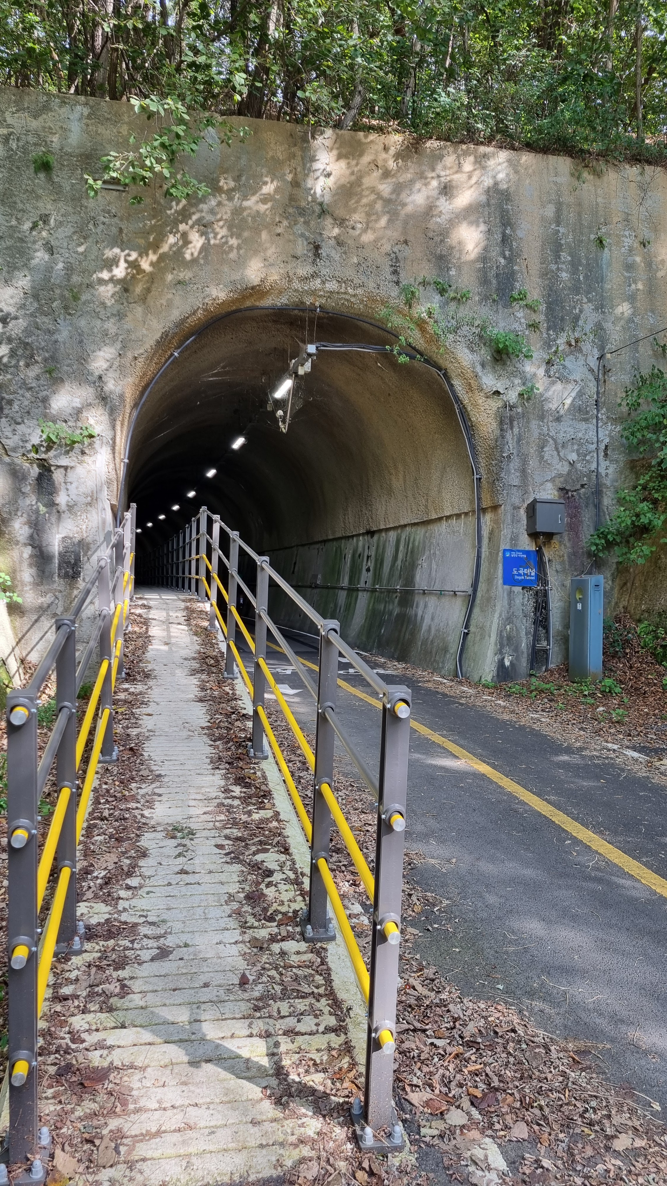
| sign for Dogok Tunnel, coming up |
 |
| Seventh tunnel: Dogok Tunnel |
 |
| This pedestrian-only ramp is a new addition. I like it. No intrusive bikers. |
 |
| You pop out of Dogok Tunnel, there's a long straightaway, a long curve right, and soon, you're at Guksu Station. |
 |
| One of the earliest sculptures to hammer home the idea that Koreans love abstract art. |
 |
| These sculptures sit just outside of Dogok Tunnel. |
 |
| the two sculptures, together in a wide shot |
 |
| As I continue on, I know there's a US-style mini-suburb coming up. |
 |
| Here's the leading edge of that suburb, with architecture familiar to Americans. |
 |
| Fascinating, Captain: a solarium at the back of this house. Rich people. |
 |
| smaller, squarish, more Korean-style dwellings |
 |
| As if someone had taken a small nibble of the rice field. The harvest has (tentatively) begun. |
 |
| a totem pole of hangari (clay pots) |
 |
| more farm neighborhoods ahead |
 |
| more rice |
 |
| a spray of cosmos |
 |
| a blue house, but not the Blue House (Korea's version of the White House) |
 |
| harvested sheaves of rice; they have to be threshed, the chaff removed, the grains left on roadside tarps to dry |
 |
Guksu Station. The running joke is that guksu is also the Korean word for noodles. The Chinese characters for this guksu, however, are 菊秀驛/국수역/guksu-yeok. The guk/국/菊 means "chrysanthemum"; the su/수/秀 means "outstanding/excellent"; and the yeok/역/驛 means "station." So, I guess this is the Station of the Excellent Chrysanthemum, not Pasta Station, as much as I want it to be that. |
Guksu Station marks the countdown point for me: only 10K to go to the end. Sometimes, I get the temptation to hop on the subway and train my way the final 10K to Yangpyeong Station. Who would know, right? But I'm now a veteran of these fights between me and my conscience, and my conscience always wins over the demon of laziness. I've never once cheated on a route in that way. Except maybe once, years ago. This time around, rest assured that I walked the entire way, as you'll see in the upcoming photos.
 |
| In front of the station is Guksu Village's Soondubu Restaurant. Soondubu is soft tofu. The stew is great. |
 |
| I popped into this Korean-style convenience store to refuel. |
 |
| And on we go. |
 |
| on the right path |
 |
| We're also on the Mulsori (Sound of Water) Path. Follow the ribbons. |
 |
| I love dilapidated things. |
 |
| those awesome rice fields |
 |
| turning right, I guess |
 |
| turn left at the footbridge (not toward 7-Eleven) |
 |
| and across |
 |
| Pass this house and turn right. |
 |
| I've long wondered about chairs and other furniture on shwimteo. Makes no sense. |
 |
| This and the previous pic are almost the same shot. |
 |
| The Korean version of Jethro or Clem lives here. |
 |
| Eighth tunnel: the Weonbok Tunnel. I found several weonbok in the hanja dictionary; I don't know which this is. |
 |
| Another raised walking platform. I love it. |
 |
| Alas, we lose the pedestrian path when we leave the tunnel. This often happens. |
 |
| shipping-container residences or offices |
 |
| house and deck, probably for a rich person or family given the size |
 |
| typical Korean architecture: functional roof with clay pots; staircase on the outside |
 |
| wider shot to show the neighborhood |
 |
| one of many exercise zones, mainly for old folks to move around |
 |
| The dog with the white head always gets me. "No pet dogs (on the route)." What about cats? |
 |
| mountainside community |
 |
| mixed architecture in a single, united building |
 |
| Rice, rice, rice... am I a riceist? Dangerous to say in Australia. |
 |
| amber waves |
 |
| I saw a few of these on the trail. Here's one. The story ended here. |
 |
| sign for the upcoming Gigok Tunnel (570 m long) |
 |
| that same warning about sunglasses and falling rock |
 |
| finally, a shadow pic |
 |
| The Ninth (and last, I think) tunnel: Gigok (Art) Tunnel. |
 |
| The raised platform puts me closer to the colored lights that used to shine and make this an "art" tunnel. |
 |
| We're now in Yangpyeong-gun, Okcheon-myeon. A gūn is a county in this case; a myeon is a village or township. |
 |
| approaching an artsy park |
 |
| wind in her hair, rings for feet, a bird in the hands |
 |
| wave or Pac-Man? |
My legs were getting stiff and tired by this point, and it was tempting to sit down and rest a spell, but I knew daylight would be fading soon enough, so I pushed on.
 |
| Mulsori-gil, Sound of Water Path (mul = water; sori = sound/noise; gil = path, road, etc.) |
Below: I did sit a few minutes around this spot to recharge my phone slightly. It's not so old that it runs out of battery quickly. Not yet, anyway. I let the phone charge up a few percent, then I left the phone attached to the power pack to continue charging as I walked; I put my backpack back on and kept walking along the right-side path. The left fork leads to residential roads. Signs warn about vehicles and bikes.
 |
| Ko-rean hillbillies! |
 |
| This has been broken like this since forever. |
 |
| There's that safety sign for helmets for bikers and belts for car passengers. |
 |
| through the tunnel and (temporarily) back out to the river |
 |
| Nice and peaceful. We're just about in the outskirts of downtown Yangpyeong. Less crowded and urban by the water. |
 |
a place called Jijoong-hae Susang Seuki: "Mediterranean Water Skiing"
ji = earth; joong = middle; su = water; sang = on top of; seuki = ski (English)
So jijoong, or "earth-middle," follows the Latin roots of Medi (middle) + terra (earth). |
 |
| Off to the right we go. |
 |
| If I'm not mistaken, this is Satan's Creek. |
 |
| We're in the Okcheon (Jade Stream) area. Painted on the bridge is an ad for Okcheon Naengmyeon (cold noodles). |
 |
| crossing the creek |
 |
The overgrown sign for Satan-cheon (the Sa-tan Creek), and even though Korean Christians do call Satan "Sa-tan," I'm pretty sure this is just a phonetic coincidence in this case. Or not. Here's a clearer picture from a previous walk for you. |
 |
| Here's the advertised naengmyeon place. |
 |
| "sharp curve" |
 |
| 110K forward to the Choongju Dam; 26K back to the Paldang Bridge |
 |
| We go under. |
 |
| Good thing I'm not 2.4 meters tall. |
 |
| Back to the quiet. |
 |
| I can look over and see a main artery into downtown Yangpyeong. |
 |
| Coming up is the Yangpyeong-daegyo (Yangpyeong Bridge). |
 |
| A tiny car... or a Star Wars escape pod? |
 |
| We're definitely moving more into downtown. |
 |
| We have to turn right and go up the footbridge. |
 |
| As I cross, I look west toward the setting sun... it's been a long day of walking. |
 |
| a look east |
 |
| down from the bridge... note the ramp-like areas for bikes |
 |
| ...and we're back by the river |
 |
| Ssangyong Water Leisure, with "leisure" spelled to sound like the British pronunciation ("LEH-zhur," not "LEE-zhur") |
When Koreans of my mother's generation learned English, British/UK pronunciation was all the rage. Then the Yanks came, and North American English (US, Canadian) has been in vogue ever since. But you still see holdovers and vestiges of British English in how some words are hangeulized, as with leisure above. Some words and expressions can even be hangeulized in both US and UK ways. Take the word news, for example. It can be written as 누우스 or 뉴스. The first rendering is more the US way to say "news"; the second is more British ("nyooz," not "nooz"). In my experience, Koreans in the States prefer the more American hangeul rendering, but they're a minority; in Korea and elsewhere, "nyooz" still reigns supreme (almost 340 million results on Google). Once a thing has been established, it's nearly impossible to unseat. Other expressions, like fry pan, turn out not to be Konglish, but to be British expressions instead! (Americans normally say frying pan, just as they say "Bring it to a boil," not the British "Bring it to the boil.")
I'll get back to the narrative before I get too caught up in US/UK differences.
Straight on to downtown Yangpyeong:
We're by the riverside until there's one final divergence pulling us away from the water.
 |
| not yet, though |
Ah—the tall building you see in the distance below (Ostar Apartments?) is right by Yangpyeong Station, so that's basically my goal for the day. Alas, despite its seeming nearness, it's still several kilometers away, so my screaming feet will have to wait before they can rest.
 |
| Onward we push. |
The following was one of the most shocking surprises along the trail. The New Paldang Bridge, the raised platforms in the tunnels—that I could handle. But below... you see how they've dug up a lot of the property. This place, whose name I don't know, is actually fenced in (I'm poking my camera through the fence); it used to hold a menagerie of animal sculptures; the animals were hilariously out of proportion: there was a modest-sized bear, a giant squirrel, giant rabbits, smallish horses, and assorted other beasts, almost all the wrong size. The bear was actually normal for a bear, but it looked small when compared to the hypertrophic squirrel. Now, though, it seems the property has been taken over and is being re-landscaped. Or maybe the owners are still the owners, and they're doing something new with the place. I have no clue. But seeing the earth turned over like that, and most of the animal sculptures gone, well... that was almost too much for my tiny brain. What will this place turn into?

At least the bear is still there. It used to wear a garland-crown, though, I think:
The absence of creatures allowed me to notice better what remained, including what appeared to be a statue of Admiral Yi Sun-shin, seen from behind:
 |
| a famous turtle ship |
And on we walk, past that shocking sight:
 |
| We're turning left and away from the river again. |
 |
| Left we go, then right across that footbridge, then right again past a Catholic church. |
 |
| We're starting to lose light. It's getting toward dinnertime, which is when I thought I'd be arriving. |
 |
| crossing the footbridge |
 |
| The church is 90 m away. |
 |
| the church, which I've been to |
 |
| I discussed the meaning of Yanggeun-seonji here, two years ago. |
 |
| Yanggeun-seonji, written vertically. |
 |
| The Christ-ankh, a curious symbol whose history I need to explore. A gift from Egyptian (Coptic) Christians? |
 |
| with more context |
 |
| Sorry for the blur. I didn't realize this bridge was permanent. |
 |
| My goal is closer. The day wanes. |
 |
| fully downtown now |
 |
| the weird, fucked-up-looking "turtle" building |
 |
| a tackily colored love motel |
 |
| aiming toward downtown |
 |
| Yanggeun Bridge |
 |
| me in my motel room |
I was dead tired when I finally collapsed at a restaurant to eat dinner, and I had to force myself to walk over to the riverside motel, where I was of course charged W65,000 for (1) it being a Saturday and (2) the riverside view. But the room was nice. No virus-ridden computer, but plenty of charger cables and decent WiFi. No mosquitoes, either. And yet... I couldn't get to sleep right away despite not even bothering to shower or to hand-wash clothes. The washing thing, well... I'd have done it had I arrived earlier, but as I'd said at the beginning of this post, I'd started way late, so I'd arrived late. I'm also dealing with the effects of a stroke in 2021 and a heart attack this past August, so I now walk even more slowly than when I was merely a stroke-only person. About 36K in almost exactly 12 hours comes out to an average speed of exactly 3 kph, which is pitifully slow. I just have to factor in my slowness from now on. Meanwhile, the next day's challenges could wait for the next day.
Eventually, sleep arrived, if fitfully. I was up at 4:30 and out the door by 5 a.m., but the next post will tell that story.


No comments:
Post a Comment
READ THIS BEFORE COMMENTING!
All comments are subject to approval before they are published, so they will not appear immediately. Comments should be civil, relevant, and substantive. Anonymous comments are not allowed and will be unceremoniously deleted. For more on my comments policy, please see this entry on my other blog.